
Gaborone: Difference between revisions
m Typo patrol, typos fixed: transporation → transportation using AWB (6839) |
|||
| Line 68: | Line 68: | ||
}} <!-- Infobox ends --> |
}} <!-- Infobox ends --> |
||
'''{{lang|tsn|Gaborone}}''' ([[Tswana language|Tswana]] {{IPA-tn|χa.bʊˈrʊ.nɪ}};{{fix|text=missing tone}} {{IPAc-en|ˌ|ɡ|æ|.|b|ə|ˈ|r|oʊ|.|n|iː}} or {{IPAc-en|ˌ|x|ɑː|.|b|ə|ˈ|r|oʊ|.|n|eɪ|}}, named after Chief [[Kgosi Gabarone]]) is the [[Capital (political)|capital]] and largest city of [[Botswana]] with a population of 191,776 based on a 2006 survey<ref name=demo /> |
'''{{lang|tsn|Gaborone}}''' ([[Tswana language|Tswana]] {{IPA-tn|χa.bʊˈrʊ.nɪ}};{{fix|text=missing tone}} {{IPAc-en|ˌ|ɡ|æ|.|b|ə|ˈ|r|oʊ|.|n|iː}} or {{IPAc-en|ˌ|x|ɑː|.|b|ə|ˈ|r|oʊ|.|n|eɪ|}}, named after Chief [[Kgosi Gabarone]]) is the [[Capital (political)|capital]] and largest city of [[Botswana]] with a population of 191,776 based on a 2006 survey.<ref name=demo /> It is the administrative capital of the [[South-East District (Botswana)|South-East District]] as well as the sub-district of Gaborone. Locals often refer to the city as ''Gabs''.<ref name=history1 /> |
||
Gaborone is situated between Kgale and Oodi Hills, on the [[Notwane River]] in the southeastern corner of Botswana, and {{convert|15|km|mi}} from the South African border<ref name=seth /> |
Gaborone is situated between Kgale and Oodi Hills, on the [[Notwane River]] in the southeastern corner of Botswana, and {{convert|15|km|mi}} from the South African border.<ref name=seth /> The city is served by the [[Sir Seretse Khama International Airport]]. |
||
==History== |
==History== |
||
| Line 77: | Line 77: | ||
[[File:Stamp Bechuanaland Protectorate 1938 6p.jpg|125px|thumb|left|A postage stamp c.1943, the postmark reading "Gaborone's Village"]] |
[[File:Stamp Bechuanaland Protectorate 1938 6p.jpg|125px|thumb|left|A postage stamp c.1943, the postmark reading "Gaborone's Village"]] |
||
[[File:1966 Mayor Gaborone.JPG|125px|thumb|left|Rev. Derek Jones, the first mayor of Gaborone]] |
[[File:1966 Mayor Gaborone.JPG|125px|thumb|left|Rev. Derek Jones, the first mayor of Gaborone]] |
||
Evidence shows that there have been inhabitants along the Notwane River for centuries. In more recent history, Chief Kgosi Gaborone left the [[Magaliesberg]] to settle in the area around 1880, and called the settlement ''[[Moshaweng]]''. The city was then called ''Gaberones'' by the early European settlers<ref name=lonelyplanet>{{cite book |last1=Hardy |first1=Paula|last2=Firestone |first2=Matthew D. |title=Botswana & Namibia |url=http://books.google.com/?id=HSAs1_B-93YC&lpg=PP1&pg=PA74#v=onepage&q= |accessdate=2009-08-04 |year=2007 |publisher=Lonely Planet |isbn=9781741047608 |chapter=Gaborone |chapterurl=http://books.google.com/books?id=HSAs1_B-93YC&lpg=PP1&pg=PA74#v=onepage&q=&f=false |pages=75–88}}</ref> |
Evidence shows that there have been inhabitants along the Notwane River for centuries. In more recent history, Chief Kgosi Gaborone left the [[Magaliesberg]] to settle in the area around 1880, and called the settlement ''[[Moshaweng]]''. The city was then called ''Gaberones'' by the early European settlers.<ref name=lonelyplanet>{{cite book |last1=Hardy |first1=Paula|last2=Firestone |first2=Matthew D. |title=Botswana & Namibia |url=http://books.google.com/?id=HSAs1_B-93YC&lpg=PP1&pg=PA74#v=onepage&q= |accessdate=2009-08-04 |year=2007 |publisher=Lonely Planet |isbn=9781741047608 |chapter=Gaborone |chapterurl=http://books.google.com/books?id=HSAs1_B-93YC&lpg=PP1&pg=PA74#v=onepage&q=&f=false |pages=75–88}}</ref> Gaberones, derived from ''Gaborone's Village'', was named after Chief Gaborone of the BaTlokwa,<ref name=seth /> whose home village, now called [[Tlokweng]], was across the river from the ''Government Camp'', the name of the colonial government headquarters. The nickname, ''GC'', comes from the name ''Government Camp''.<ref name=history1 /> In 1890, [[Cecil John Rhodes]] picked Gaberones to house a colonial fort.<ref name=history2>{{cite web |title=African cities- Gaborone History |url=http://gaborone.info/php/gabhist.php?name=Gaborone%20History |work= Gaborone.info|publisher=AfricanCities.net |accessdate=2009-08-04}}</ref> The fort was where Rhodes planned the [[Jameson Raid]].<ref name=lonelyplanet /> The city changed its name from ''Gaberones'' to ''Gaborone'' in 1969.<ref>{{cite news | title = Regions Given New Spelling | url = http://news.google.com/newspapers?id=7bszAAAAIBAJ&sjid=IfgDAAAAIBAJ&dq=gaborone&pg=7329%2C1913552 | agency = Associated Press | newspaper = Spokane Daily Chronicle | location = Spokane, Washington, USA | date = 1969-12-22 | page = 11 | accessdate =2010-07-11 }}</ref> |
||
In 1965, the capital of the [[Bechuanaland Protectorate]] moved from [[Mafikeng|Mafeking]] to Gaberones. When Botswana gained its independence, [[Lobatse]] was the first choice as the nation's capital. However, Lobatse was deemed too limited, and instead, a new capital city would be created next to Gaberones<ref name=history1>{{cite web |first=Purity |last=Njeru |title=History of Gaborone |url=http://www.africanexecutive.com/modules/magazine/articles.php?article=703 |publisher=[[The African Executive]]|location= Nairobi, Kenya |year=2009 |accessdate=2009-08-04}}</ref> |
In 1965, the capital of the [[Bechuanaland Protectorate]] moved from [[Mafikeng|Mafeking]] to Gaberones. When Botswana gained its independence, [[Lobatse]] was the first choice as the nation's capital. However, Lobatse was deemed too limited, and instead, a new capital city would be created next to Gaberones.<ref name=history1>{{cite web |first=Purity |last=Njeru |title=History of Gaborone |url=http://www.africanexecutive.com/modules/magazine/articles.php?article=703 |publisher=[[The African Executive]]|location= Nairobi, Kenya |year=2009 |accessdate=2009-08-04}}</ref> The city was chosen because of its proximity to a fresh water source, its proximity to the railway to [[Pretoria]], its central location among the central tribes, and its lack of association with those surrounding tribes.<ref name=seth>{{cite book |last1=Seth |first1=Willie |title=Botswana and Its People |url=http://books.google.com/?id=bR54xeODwCIC&lpg=PA44&pg=PA44#v=onepage&q= |accessdate=2009-08-04 |year=2008 |publisher=Godfrey Mwakikagile |isbn=9780981425870 |chapter=Major urban centres |chapterurl=http://books.google.com/books?id=bR54xeODwCIC&lpg=PA43&pg=PA43#v=onepage&q=&f=false |pages=44–46}}</ref> |
||
The city was planned under [[Garden city movement|Garden city principles]] with numerous pedestrian walkways and open spaces<ref name=economy>{{Cite book|last1= Keiner|first1=Marco|last2= Zegras|first2=Christopher|last3= Schmid|first3=Willy A.|editor1-last= Keiner|editor1-first= Marco|editor2-last= Zegras|editor2-first= Christopher|editor3-last= Schmid|editor3-first= Willy A.|editor4-last= Salmerón|editor4-first= Diego | title =From understanding to action: sustainable urban development in medium-sized cities in Africa and Latin America|pages=19, 63, 68, 93 | url =http://books.google.com/?id=eHZYT0-SsSEC | publisher=Springer|year=2004|isbn=9781402028793 | accessdate =2009-08-06}}</ref> |
The city was planned under [[Garden city movement|Garden city principles]] with numerous pedestrian walkways and open spaces.<ref name=economy>{{Cite book|last1= Keiner|first1=Marco|last2= Zegras|first2=Christopher|last3= Schmid|first3=Willy A.|editor1-last= Keiner|editor1-first= Marco|editor2-last= Zegras|editor2-first= Christopher|editor3-last= Schmid|editor3-first= Willy A.|editor4-last= Salmerón|editor4-first= Diego | title =From understanding to action: sustainable urban development in medium-sized cities in Africa and Latin America|pages=19, 63, 68, 93 | url =http://books.google.com/?id=eHZYT0-SsSEC | publisher=Springer|year=2004|isbn=9781402028793 | accessdate =2009-08-06}}</ref> Building of Gaborone started in mid-1964. During the city's construction, the chairman of Gaberones Township Authority, Geoffrey Cornish, likened the layout of the city to a “brandy glass” with the government offices in the base of the glass and businesses in the “mall”, a strip of land extending from the base.<ref name=Eugene>{{cite news | title = Capital City Being Built On Virgin Soil | author = Paine, David J. | url = http://news.google.com/newspapers?id=7uQQAAAAIBAJ&sjid=-OADAAAAIBAJ&dq=gaberones&pg=4458%2C3421646 | agency = Associated Press | newspaper = Eugene Register-Guard | location = Eugene, Oregon, USA | date = 1966-04-15 | at = section D, p. 3 | accessdate =2010-07-11 }}</ref> |
||
Most of the city was built within three years. Buildings in early Gaborone include Assembly buildings, government offices, a power station, a hospital, schools, a radio station, a telephone exchange, police stations, a post office, and more than 1,000 houses<ref name=architecture>{{cite web |author=killion |title=The Unsustainable urban growth of Gaborone City, Botswana |url=http://www.boidus.co.uk/?p=1188 |publisher=Boidus: Blogs|date=2009-06-29 |accessdate=2009-08-04}}</ref> |
Most of the city was built within three years. Buildings in early Gaborone include Assembly buildings, government offices, a power station, a hospital, schools, a radio station, a telephone exchange, police stations, a post office, and more than 1,000 houses.<ref name=architecture>{{cite web |author=killion |title=The Unsustainable urban growth of Gaborone City, Botswana |url=http://www.boidus.co.uk/?p=1188 |publisher=Boidus: Blogs|date=2009-06-29 |accessdate=2009-08-04}}</ref> Because the city was built so quickly, there was a massive influx of labourers who had built illegal settlements on the new city's southern industrial development zone. These settlements were named Naledi. ''Naledi'' literally means ''the star'', but could also mean ''under the open sky'' or ''a community that stands out from all others''. In 1971, because of the growth of illegal settlements, the Gaborone Town Council and the Ministry of Local Government and Lands surveyed an area called Bontleng, which would contain low-income housing. However, Naledi still grew, and the demand for housing was greater than ever. In 1973, the Botswana Housing Corporation (BHC) built a "New Naledi" across the road from the "Old Naledi". Residents from Old Naledi would be moved to New Naledi. However, the demand for housing increased yet again; moreover, the residents who relocated to New Nadeli disliked the houses. The problem was solved in 1975 when Sir Seretse Khama, the president of Botswana, rezoned Naledi from an industrial zone to a low-income housing area.<ref>{{Cite book|title=Old Naledi, the village becomes a town: an outline of the Old Naledi Squatter Upgrading Project, Gaborone, Botswana|last=Van Nostrand|first=John Cornelius|publisher=James Lorimer & Company|year=1982|isbn=9780888626509|accessdate=2009-09-19|url=http://books.google.com/?id=qGjfAc4J1yUC&lpg=PP13&pg=PP13#v=onepage&q=|chapter=Old Naledi: History of Settlement|chapterurl=http://books.google.com/books?id=qGjfAc4J1yUC&lpg=PP13&pg=PP13#v=onepage&q=&f=false|pages=13–15}}</ref> |
||
On 30 September 1966, [[Bechuanaland]] became the eleventh [[British dependency]] in Africa to become independent. The first mayor of Gaborone was Reverend Derek Jones<ref name=jones>{{Cite book | last =Grant | first =Sandy | date =2009-06-18 | title =Our Heritage. |location=Gaborone, Botswana|publisher=[[Mmegi|Mmegi Online]] | url =http://www.mmegi.bw/index.php?sid=6&aid=12&dir=2009/June/Thursday18 | accessdate =2009-08-06| volume=26 | issue=91}}</ref> |
On 30 September 1966, [[Bechuanaland]] became the eleventh [[British dependency]] in Africa to become independent. The first mayor of Gaborone was Reverend Derek Jones.<ref name=jones>{{Cite book | last =Grant | first =Sandy | date =2009-06-18 | title =Our Heritage. |location=Gaborone, Botswana|publisher=[[Mmegi|Mmegi Online]] | url =http://www.mmegi.bw/index.php?sid=6&aid=12&dir=2009/June/Thursday18 | accessdate =2009-08-06| volume=26 | issue=91}}</ref> The old Gaberones became a [[suburb]] of the new Gaborone, and is now known as "the Village".<ref name=history1 /> |
||
In the mid-1980s, South Africa attacked Botswana and conducted raids on Gaborone and other border towns. The raids resulted in fifteen civilian deaths<ref name=botswana /> |
In the mid-1980s, South Africa attacked Botswana and conducted raids on Gaborone and other border towns. The raids resulted in fifteen civilian deaths.<ref name=botswana /> |
||
After the [[Botswana general election, 1994|1994 General Elections]], riots started in Gaborone because of high unemployment and other issues<ref name=botswana /> |
After the [[Botswana general election, 1994|1994 General Elections]], riots started in Gaborone because of high unemployment and other issues.<ref name=botswana /> |
||
Today, Gaborone is growing very rapidly. The city originally planned on 20,000 citizens, but by 1992, the city had 138,000 people. This has led to many squatter settlements on undeveloped land<ref>{{Cite book|last1=Carr|first1=Michael | title =New patterns: process and change in human geography|chapter=The form and future shape of the modem city|page=224|chapterurl=http://books.google.com/books?id=7lKIMAS_7hoC&lpg=PA211&pg=PA211#v=onepage&q=&f=false | url =http://books.google.com/?id=7lKIMAS_7hoC&lpg=PA211&pg=PA224#v=onepage&q= | publisher=Nelson Thornes|year=1997|edition=2nd|isbn=9780174386810 | accessdate =2009-08-06}}</ref> |
Today, Gaborone is growing very rapidly. The city originally planned on 20,000 citizens, but by 1992, the city had 138,000 people. This has led to many squatter settlements on undeveloped land.<ref>{{Cite book|last1=Carr|first1=Michael | title =New patterns: process and change in human geography|chapter=The form and future shape of the modem city|page=224|chapterurl=http://books.google.com/books?id=7lKIMAS_7hoC&lpg=PA211&pg=PA211#v=onepage&q=&f=false | url =http://books.google.com/?id=7lKIMAS_7hoC&lpg=PA211&pg=PA224#v=onepage&q= | publisher=Nelson Thornes|year=1997|edition=2nd|isbn=9780174386810 | accessdate =2009-08-06}}</ref> |
||
==Geography== |
==Geography== |
||
Gaborone is situated at {{Coord|24|39|29|S|25|54|44|E}} between Kgale and Oodi Hills, on the Notwane River in the southeastern corner of Botswana, and {{convert|15|km|mi}} from the South African border<ref name=seth /> |
Gaborone is situated at {{Coord|24|39|29|S|25|54|44|E}} between Kgale and Oodi Hills, on the Notwane River in the southeastern corner of Botswana, and {{convert|15|km|mi}} from the South African border<ref name=seth /> |
||
Gaborone is surrounded by the following cities: [[Ramotswa]] to the southeast, [[Mogoditshane]] to the northwest, and [[Mochudi]] to the east, and [[Tlokweng]] across the river. Most of them are [[commuter town]]s for Gaborone. Suburbs in Gaborone include Broadhurst, Gaborone West, The Village, Naledi<ref name=seth /> |
Gaborone is surrounded by the following cities: [[Ramotswa]] to the southeast, [[Mogoditshane]] to the northwest, and [[Mochudi]] to the east, and [[Tlokweng]] across the river. Most of them are [[commuter town]]s for Gaborone. Suburbs in Gaborone include Broadhurst, Gaborone West, The Village, Naledi,<ref name=seth /> and New Canada. Phakalane, an affluent suburb, lies outside the city limits.<ref name=phakalane>{{cite web |author=Phakalane Properties |title=Gaborone Information - Phakalane Properties, Botswana |url=http://www.phakalane.co.bw/area_info.php?area=Durban%20Upper%20Highway&areainfoID=67 |location=Phakalane, Botswana |year= 2008 |accessdate=2009-08-04}}</ref> |
||
{{Geographic Location |
{{Geographic Location |
||
|Centre = Gaborone |
|Centre = Gaborone |
||
| Line 126: | Line 126: | ||
|source=<ref name=enviro>{{cite web|url=http://www.cso.gov.bw/images/stories/Enviro/naturaldisasters_digest.pdf|author=Central Statistics Office|location=Gaborone, Botswana|accessdate=2010-07-03|format=PDF|date=2009-08|title=NATURAL DISASTERS DIGEST 2008}}</ref> |
|source=<ref name=enviro>{{cite web|url=http://www.cso.gov.bw/images/stories/Enviro/naturaldisasters_digest.pdf|author=Central Statistics Office|location=Gaborone, Botswana|accessdate=2010-07-03|format=PDF|date=2009-08|title=NATURAL DISASTERS DIGEST 2008}}</ref> |
||
}} |
}} |
||
Gaborone has a hot [[semi-arid climate]] ([[Köppen climate classification]] ''[[Semi-arid climate#Hot Semi-arid climates|''BSh'']]''). Most of the year, Gaborone is very sunny. The summers are usually hot. The nights are cool. Usually, the summers with little rainfall are warmer than summers with regular rainfall. If there is a drought, the hottest temperatures of the year are usually in January of February. If there is normal rainfall, the hottest temperatures are usually in October, right before the rain starts. During the winter, days are still warm, and the nights are cold<ref name=climate /> |
Gaborone has a hot [[semi-arid climate]] ([[Köppen climate classification]] ''[[Semi-arid climate#Hot Semi-arid climates|''BSh'']]''). Most of the year, Gaborone is very sunny. The summers are usually hot. The nights are cool. Usually, the summers with little rainfall are warmer than summers with regular rainfall. If there is a drought, the hottest temperatures of the year are usually in January of February. If there is normal rainfall, the hottest temperatures are usually in October, right before the rain starts. During the winter, days are still warm, and the nights are cold.<ref name=climate /> |
||
There are on average seventy-four days per year with temperatures above {{convert|32|°C|°F}}. There is on average 196 days per year with temperatures above {{convert|26|°C|°F}}. There is on average fifty-one days per year with temperatures below {{convert|7|°C|°F}}. There is on average one day per year with temperatures below {{convert|0|°C|°F}}<ref name=temperature /> |
There are on average seventy-four days per year with temperatures above {{convert|32|°C|°F}}. There is on average 196 days per year with temperatures above {{convert|26|°C|°F}}. There is on average fifty-one days per year with temperatures below {{convert|7|°C|°F}}. There is on average one day per year with temperatures below {{convert|0|°C|°F}}.<ref name=temperature /> The average dew point peaks around January and February at {{convert|16|°C|°F}} and hits the lowest levels in July at {{convert|2|°C|°F}}. The average dew point in a given year is {{convert|10|°C|°F}}.<ref name=temperature /> |
||
Precipitation in Gaborone is sparse and variable. Most of the rainfall in Gaborone falls during the summer months, between October and April<ref name=climate /> |
Precipitation in Gaborone is sparse and variable. Most of the rainfall in Gaborone falls during the summer months, between October and April.<ref name=climate /> There is on average forty days of thunderstorms per year, most of them happening during the summer months, and four days of fog, usually happening during the winter months.<ref name=temperature >{{cite web| url =http://www.weatherbase.com/weather/weather.php3?s=44286&refer=&units=metric | title =Weatherbase: Historical Weather for Gaborone, Botswana | accessdate = 2009-08-04| publisher =Weatherbase }}</ref> Gaborone has been affected by three floods based on records going back to 1995, one in 2000, one in 2001 that caused an estimated 5,000,000 [[Botswana pula]] worth of damage, and one in 2006.<ref name=enviro /> |
||
The highest humidity occurs in June at 90% while the lowest humidity is in September at 28%<ref name=climate /> |
The highest humidity occurs in June at 90% while the lowest humidity is in September at 28%.<ref name=climate /> |
||
Solar radiation levels range from 14.6 MJ/m² in June to 26.2 MJ/m² in December<ref name=climate>{{Cite news | first =Carl | last =Bauer | year =2005 | title =Climate | periodical =Energy Efficiency and Energy Conservation in the Building Sector in Botswana | place =Gaborone, Botswana | publisher = Bauer Consult | pages =6–13 | url =http://www.bauerconsultbotswana.com/3_Climate.pdf | accessdate =2009-08-04}}</ref> |
Solar radiation levels range from 14.6 MJ/m² in June to 26.2 MJ/m² in December.<ref name=climate>{{Cite news | first =Carl | last =Bauer | year =2005 | title =Climate | periodical =Energy Efficiency and Energy Conservation in the Building Sector in Botswana | place =Gaborone, Botswana | publisher = Bauer Consult | pages =6–13 | url =http://www.bauerconsultbotswana.com/3_Climate.pdf | accessdate =2009-08-04}}</ref> |
||
It is windier from August to November at {{convert|14|km/h|mph}}, and it is calmer from May to July at {{convert|8|km/h|mph}}. The average wind speed in a given year is {{convert|12|km/h|mph}}<ref name=temperature /> |
It is windier from August to November at {{convert|14|km/h|mph}}, and it is calmer from May to July at {{convert|8|km/h|mph}}. The average wind speed in a given year is {{convert|12|km/h|mph}}.<ref name=temperature /> |
||
{{ - }} |
{{ - }} |
||
{{Infobox Weather |
{{Infobox Weather |
||
| Line 225: | Line 225: | ||
}} |
}} |
||
The population, based on a 2006 survey, is 191,776. There are 92,859 males and 98,917 females in the city<ref name=demo /> |
The population, based on a 2006 survey, is 191,776. There are 92,859 males and 98,917 females in the city.<ref name=demo /> There are 58,476 households in Gaborone.<ref name=census>{{Cite web|author=Central Statistics Office|title=Table 1.1: Population by sex and census districts (1991 And 2001)|url=http://www.cso.gov.bw/index.php?option=com_content&task=view&id=142&Itemid=89|accessdate=2009-08-05|date=2008-02-07|origyear=2001|location=Gaborone, Botswana}}</ref> The city of Gaborone is home to over 10% of the population of Botswana.<ref name=demo /><ref name=botswana /> |
||
The [[Population growth|population growth rate]] of Gaborone is 3.4%, the highest in the country. This is most likely because the city has a more developed infrastructure, making it more livable<ref name=census2>{{Cite web|author=Central Statistics Office|title=2001 POPULATION CENSUS ATLAS: BOTSWANA|url=http://www.cso.gov.bw/images/stories/Census_Publication/pop%20atlas.pdf|accessdate=2009-08-05|date=February 2005|location=Gaborone, Botswana|format=PDF}}</ref> |
The [[Population growth|population growth rate]] of Gaborone is 3.4%, the highest in the country. This is most likely because the city has a more developed infrastructure, making it more livable.<ref name=census2>{{Cite web|author=Central Statistics Office|title=2001 POPULATION CENSUS ATLAS: BOTSWANA|url=http://www.cso.gov.bw/images/stories/Census_Publication/pop%20atlas.pdf|accessdate=2009-08-05|date=February 2005|location=Gaborone, Botswana|format=PDF}}</ref> Gaborone is one of the fastest-growing cities in the world.<ref name=seth /> |
||
The [[human sex ratio|sex ratio]] of Gaborone is 97.6, meaning that there are 976 men for every 1,000 women<ref name=census2 /> |
The [[human sex ratio|sex ratio]] of Gaborone is 97.6, meaning that there are 976 men for every 1,000 women.<ref name=census2 /> Most of the marriages in Botswana are registered in Gaborone; about 15% of all marriages in Botswana were registered in Gaborone in 2007.<ref>{{cite web |url=http://www.cso.gov.bw/images/stories/StatsBrief/marriages_june_2010.pdf |title=MARRIAGE STATISTICS 2007 |author=A. N. Majelantle |month=May |year=2010 |work=STATS BRIEF |publisher=Central Statistics Office |location=Gaborone, Botswana |page=2 |format=PDF |archiveurl=http://www.webcitation.org/5qyc2XAMi |archivedate=2010-07-04 |accessdate=2010-07-06 }}</ref> On average, there are 3.3 persons per househould in Gaborone. This is a low number compared to the rest of Botswana.<ref name=demo>{{cite web| url=http://www.cso.gov.bw/images/stories/HouseHold/2006_bdsrprt.pdf|title=BOTSWANA DEMOGRAPHIC SURVEY 2006|author=Central Statistics Office|location=Gaborone, Botswana|accessdate=2010-07-03|date=2009-01|format=PDF}}</ref> |
||
It is estimated that over one-third of the people living in Gaborone, 38.8%, have [[HIV]]—the highest prevalence in the world. The rate is even higher for people between the ages of 15 and 49 at 44%<ref name=economy /> |
It is estimated that over one-third of the people living in Gaborone, 38.8%, have [[HIV]]—the highest prevalence in the world. The rate is even higher for people between the ages of 15 and 49 at 44%.<ref name=economy /> |
||
===Religion=== |
===Religion=== |
||
[[File:Botswana - Diocesi di Gaborone.png|thumb|150px|right|Map of the Diocese of Gaborone]] |
[[File:Botswana - Diocesi di Gaborone.png|thumb|150px|right|Map of the Diocese of Gaborone]] |
||
The [[Roman Catholic Diocese of Gaborone]], which is under the [[Roman Catholic Archdiocese of Pretoria]], is located in the city. The [[diocese]] contains the southern half of Botswana, and the bishop for the diocese is Bishop Valentine Tsamma Seane who was consecrated on 25 April 2009. The previous bishop was [[Boniface Tshosa Setlalekgosi]]. There is a catholic cathedral called Christ the King Cathedral<ref>{{Cite web|url=http://www.catholic-hierarchy.org/diocese/dgabo.html|title=Gaborone (Diocese) [Catholic-Hierarchy]|last= Cheney|first=David M.|date=2009-05-10|accessdate=2009-08-06|work=Dioceses|publisher=www.Cathoic-Hierarchy.org}}</ref><ref>{{Cite book|url=http://www.gcatholic.com/dioceses/diocese/gabo0.htm|title=Diocese of Gaborone, Botswana|date=2009-07-19|accessdate=2009-08-06|work=Dioceses|publisher=Giga-Catholic Information}}</ref> |
The [[Roman Catholic Diocese of Gaborone]], which is under the [[Roman Catholic Archdiocese of Pretoria]], is located in the city. The [[diocese]] contains the southern half of Botswana, and the bishop for the diocese is Bishop Valentine Tsamma Seane who was consecrated on 25 April 2009. The previous bishop was [[Boniface Tshosa Setlalekgosi]]. There is a catholic cathedral called Christ the King Cathedral.<ref>{{Cite web|url=http://www.catholic-hierarchy.org/diocese/dgabo.html|title=Gaborone (Diocese) [Catholic-Hierarchy]|last= Cheney|first=David M.|date=2009-05-10|accessdate=2009-08-06|work=Dioceses|publisher=www.Cathoic-Hierarchy.org}}</ref><ref>{{Cite book|url=http://www.gcatholic.com/dioceses/diocese/gabo0.htm|title=Diocese of Gaborone, Botswana|date=2009-07-19|accessdate=2009-08-06|work=Dioceses|publisher=Giga-Catholic Information}}</ref> |
||
There is a [[Hindu temple]] in Gaborone, nicknamed ''[[Hinduism in Botswana#Hindu Temple.2C Gaborone|Hindu Hall]]'', as well as a [[gurudwara]] and a [[mosque]]<ref>{{Cite book|author=High Level Committee On Indian Diaspora|date =2001-12-19|title =Report of the High Level Committee on the Indian Diaspora|place =New Delhi|volume =2|pages=102–103|url =http://indiandiaspora.nic.in/diasporapdf/chapter8.pdf|chapter=Chapter 8 – Other Countries of Africa |chapterurl=http://indiandiaspora.nic.in/diasporapdf/chapter8.pdf|accessdate =2009-08-06}}</ref> |
There is a [[Hindu temple]] in Gaborone, nicknamed ''[[Hinduism in Botswana#Hindu Temple.2C Gaborone|Hindu Hall]]'', as well as a [[gurudwara]] and a [[mosque]].<ref>{{Cite book|author=High Level Committee On Indian Diaspora|date =2001-12-19|title =Report of the High Level Committee on the Indian Diaspora|place =New Delhi|volume =2|pages=102–103|url =http://indiandiaspora.nic.in/diasporapdf/chapter8.pdf|chapter=Chapter 8 – Other Countries of Africa |chapterurl=http://indiandiaspora.nic.in/diasporapdf/chapter8.pdf|accessdate =2009-08-06}}</ref> Construction started in May 2001 on a [[Venkateswara#Notable Venkateswara temples outside of India|Venkateswara temple]] in Gaborone West for a local community of [[Telugu people]] by the Botswana Hindu Charities Trust<ref>{{Cite book | date =2006-02-27 | title =African abode for the Lord of the Seven Hills | place =Hyderabad | url=http://www.hindu.com/2006/02/27/stories/2006022714500500.htm | publisher=The Hindu|work=Andhra Pradesh | accessdate =2009-08-06}}</ref> and was complete in September 2007. The Indian High Commissioner, and the President [[Festus Mogae]] visited the temple upon its completion.<ref>{{Cite book | date =2007-09-19 | title =Dinamalar.com _ Ulagatamilargal | url =http://www.dinamalar.com/Ulagatamilargal_English/2007sep19/Africa.asp | publisher=Dina Malar|work=Africa | accessdate =2009-08-06}}</ref> |
||
==Arts and culture== |
==Arts and culture== |
||
The [[Botswana National Museum|National Museum and Art Gallery]] is located just northwest of the Mall along Independence Road<ref name=map /> |
The [[Botswana National Museum|National Museum and Art Gallery]] is located just northwest of the Mall along Independence Road.<ref name=map /> The museum opened in 1968. It holds many things from traditional crafts to works of art by local artists. The museum houses original paintings by [[Thomas Baines]] and [[Lucas Sithole]]. Exhibits include ''Artists in Botswana'', ''Children's Art Competition'' and ''Thapong International''. Outside the museum, there are various forms of transportation such as wagons, sledges, and ''bakkies'' ([[pickup truck]]s).<ref>{{cite web |author=Botswana Tourism Board |title=The National Museum and Art Gallery |url=http://www.botswanatourism.co.bw/attractions/national_museum_and_artgallery.html |work= Attractions|publisher=Botswana Tourism Board |accessdate=2009-08-05}}</ref> There is also an exhibit on the [[Bushmen]], the earliest inhabitants of [[southern Africa]].<ref name=yeah>{{cite web |title=Gabarone Holidays – a Visit to the Vibrant Cosmopolitan Capital|url=http://www.syl.com/travel/gabaroneholidaysavisittothevibrantcosmopolitancapital.html |date=2006-05-24 |accessdate=2009-08-05}}</ref> The museum opened a {{convert|3.6|ha|acre|adj=on|sigfig=1}}<ref name=garden>{{Cite web|title=National Botanical Garden|author=Botanic Gardens Conservation International|url=http://www.bgci.org/garden.php?id=2254&ftrCountry=BW&ftrKeyword=&ftrBGCImem=&ftrIAReg=|accessdate=2009-09-19}}</ref> [[botanical garden]] called the [[National Botanical Garden (Botswana)|National Botanical Garden]] on 2 November 2007.<ref>{{Cite web|url=http://www.gov.bw/cgi-bin/news.cgi?d=20071025&i=National_Museum_to_launch_botanical_garden|title=National Museum to Launch Botanical Garden|accessdate=2009-08-05|publisher=Republic of Botswana|date=2007-10-25|work=Daily News Online}}</ref> The garden was built to protect Botswana's indigenous plant life, and 90% of its total plant species are native plants from Botswana.<ref name=garden /> |
||
The [[Maitisong Festival]] was started in 1987 and is held every year for seven days on either the last week of March or the first week of April. The festival holds outdoor concerts, plays, and movies in various venues around the city<ref name=lonelyplanet /> |
The [[Maitisong Festival]] was started in 1987 and is held every year for seven days on either the last week of March or the first week of April. The festival holds outdoor concerts, plays, and movies in various venues around the city.<ref name=lonelyplanet /> |
||
“[[My African Dream]]” is a performing-arts competition that is held every year at the [[Gaborone International Convention Center]]. The show features many ''[[kwaito]]'' dancers and musicians<ref name=botswana /> |
“[[My African Dream]]” is a performing-arts competition that is held every year at the [[Gaborone International Convention Center]]. The show features many ''[[kwaito]]'' dancers and musicians.<ref name=botswana /> |
||
The book series, [[The No. 1 Ladies' Detective Agency]], is set in Gaborone. The series is written by [[Alexander McCall Smith]]. The books follow [[Precious Ramotswe]], the first female private detective in Botswana, and the mysteries that she solves. |
The book series, [[The No. 1 Ladies' Detective Agency]], is set in Gaborone. The series is written by [[Alexander McCall Smith]]. The books follow [[Precious Ramotswe]], the first female private detective in Botswana, and the mysteries that she solves. |
||
| Line 251: | Line 251: | ||
[[File:Debswana HQ.jpg|thumb|right|Debswana offices in downtown Gaborone]] |
[[File:Debswana HQ.jpg|thumb|right|Debswana offices in downtown Gaborone]] |
||
[[File:SADC HQ2.jpg|thumb|left|SADC headquarters in Gaborone]] |
[[File:SADC HQ2.jpg|thumb|left|SADC headquarters in Gaborone]] |
||
Gaborone is the center of the national economy. The headquarters of important financial institutions such as the [[Bank of Botswana]], [[Bank Gaborone]],[[BancABC]], and the [[Botswana Stock Exchange]] are located downtown, as well as the headquarters for [[Air Botswana]], [[Consumer Watchdog (Botswana)|Consumer Watchdog]], [[Botswana Telecommunications Corporation]], and [[Debswana]], the joint diamond mining venture between [[De Beers]]and the Botswana government. The [[Southern African Development Community]] (SADC) has its headquarters in Gaborone; the organization was formed in 1980 to increase economic cooperation among its members and reduce dependence on [[South Africa]]<ref name=seth /> |
Gaborone is the center of the national economy. The headquarters of important financial institutions such as the [[Bank of Botswana]], [[Bank Gaborone]],[[BancABC]], and the [[Botswana Stock Exchange]] are located downtown, as well as the headquarters for [[Air Botswana]], [[Consumer Watchdog (Botswana)|Consumer Watchdog]], [[Botswana Telecommunications Corporation]], and [[Debswana]], the joint diamond mining venture between [[De Beers]]and the Botswana government. The [[Southern African Development Community]] (SADC) has its headquarters in Gaborone; the organization was formed in 1980 to increase economic cooperation among its members and reduce dependence on [[South Africa]].<ref name=seth /> |
||
Orapa House, owned by [[Debswana]] through the Botswana Diamond Valuing Company (BDVC), is where the diamonds mined from Debswana are sorted and valued<ref>{{cite web |author=Debswana|title=BOTSWANA DIAMOND VALUING COMPANY|url=http://www.debswana.com/Debswana.Web/About+Debswana/Investments/Botswana+Diamond+Valuing+Company/| work = ABOUT DEBSWANA|publisher=Debswana|accessdate=2009-08-05}}</ref> |
Orapa House, owned by [[Debswana]] through the Botswana Diamond Valuing Company (BDVC), is where the diamonds mined from Debswana are sorted and valued.<ref>{{cite web |author=Debswana|title=BOTSWANA DIAMOND VALUING COMPANY|url=http://www.debswana.com/Debswana.Web/About+Debswana/Investments/Botswana+Diamond+Valuing+Company/| work = ABOUT DEBSWANA|publisher=Debswana|accessdate=2009-08-05}}</ref> Orapa House, located at the intersection of Khama Crescent and Nelson Mandela Drive,<ref name=map /> has a unique style of architecture that allows the perfect amount of indirect sunlight to shine through the windows in order to accurately sort diamonds.<ref name=culture>{{cite web |title=African cities- Gaborone Culture |url=http://gaborone.info/php/gabculture.php?name=Gaborone%20Culture |work= Gaborone.info|publisher=AfricanCities.net |accessdate=2009-08-05}}</ref> |
||
According to [[Mercer (consulting firm)|Mercer]]'s 2010 [[List of most expensive cities for expatriate employees|Worldwide Cost of Living Survey]], Gaborone has the 203rd highest [[cost of living]] for [[expatriate]]s in the world. Gaborone is the third least expensive city for expatriates in Africa, coming in above [[Addis Ababa]], [[Ethiopia]] at 208th and [[Windhoek]], [[Namibia]] at 205th. [[Karachi]], [[Pakistan]] ranks last in the world at 214<ref>{{cite web |url=http://www.mercer.com/costoflivingpr |title=Worldwide Cost of Living survey 2010 - City rankings |date=2010-06-29 |work=Cost of Living Survey |publisher=Mercer |location=London |accessdate=2010-07-06 }}</ref> |
According to [[Mercer (consulting firm)|Mercer]]'s 2010 [[List of most expensive cities for expatriate employees|Worldwide Cost of Living Survey]], Gaborone has the 203rd highest [[cost of living]] for [[expatriate]]s in the world. Gaborone is the third least expensive city for expatriates in Africa, coming in above [[Addis Ababa]], [[Ethiopia]] at 208th and [[Windhoek]], [[Namibia]] at 205th. [[Karachi]], [[Pakistan]] ranks last in the world at 214.<ref>{{cite web |url=http://www.mercer.com/costoflivingpr |title=Worldwide Cost of Living survey 2010 - City rankings |date=2010-06-29 |work=Cost of Living Survey |publisher=Mercer |location=London |accessdate=2010-07-06 }}</ref> |
||
==Sports== |
==Sports== |
||
| Line 280: | Line 280: | ||
[[File:Gaborone 25.92305E 24.68895S.jpg|thumb|200px|right|Satellite picture of Gaborone with the large lake being the Gaborone Dam]] |
[[File:Gaborone 25.92305E 24.68895S.jpg|thumb|200px|right|Satellite picture of Gaborone with the large lake being the Gaborone Dam]] |
||
====Gaborone Dam==== |
====Gaborone Dam==== |
||
The Gaborone Dam is located south of Gaborone along the Gaborone-Lobatse road, and provides water for both Gaborone and Lobatse. The [[dam]] is the biggest in Botswana, able to hold {{convert|141400000|m3|USgal|sigfig=4|lk=on}}<ref name=water>{{cite web| url =http://www.cso.gov.bw/images/stories/Enviro/botswanawater_statisticsreport.pdf| title = BOTSWANA WATER STATISTICS| first = A.| last = Majelantle| month = October| year = 2009| work = Botswana Water Statistics| publisher = Central Statistics Office| location = Gaborone, Botswana| format = PDF| archiveurl = http://www.webcitation.org/5r28HPAkm| archivedate = 2010-07-07| accessdate = 2010-07-07}}</ref> |
The Gaborone Dam is located south of Gaborone along the Gaborone-Lobatse road, and provides water for both Gaborone and Lobatse. The [[dam]] is the biggest in Botswana, able to hold {{convert|141400000|m3|USgal|sigfig=4|lk=on}}.<ref name=water>{{cite web| url =http://www.cso.gov.bw/images/stories/Enviro/botswanawater_statisticsreport.pdf| title = BOTSWANA WATER STATISTICS| first = A.| last = Majelantle| month = October| year = 2009| work = Botswana Water Statistics| publisher = Central Statistics Office| location = Gaborone, Botswana| format = PDF| archiveurl = http://www.webcitation.org/5r28HPAkm| archivedate = 2010-07-07| accessdate = 2010-07-07}}</ref> It is also starting to be marketed as a recreational area. The northern end of the reservoir is planned to become an entertainment venue called ''The Waterfront''. There is a [[yacht club]], called [http://www.gyc.org.bw/Home Gaborone Yacht Club], also on the northern side of the lake. The southern end houses the Kalahari Fishing Club and a new public facility called City Scapes. City Scapes contains parks, playgrounds, and boating facilities.<ref name=architecture1>{{cite web |author = Gabscity.com |location=Gaborone, Botswana| title = City – Gabscity.com all about Gaborone | url = http://www.gabscity.com/city/index.php| accessdate = 2009-08-04 }}</ref> The dam is popular with [[birdwatching|birdwatchers]], [[windsurfing|windsurfers]], and [[fishing|anglers]].<ref name=lonelyplanet /> However, there is no swimming due to [[crocodile]]s and parasitic [[Schistosoma|bilharzia]]s.<ref name=culture /> |
||
====Gaborone Game Reserve==== |
====Gaborone Game Reserve==== |
||
The [[Gaborone Game Reserve]] is a [[1 E+6 m²|{{convert|600|ha|acre|adj=on}}]] [[park]] west of the city on Limpopo Drive<ref name=map /> |
The [[Gaborone Game Reserve]] is a [[1 E+6 m²|{{convert|600|ha|acre|adj=on}}]] [[park]] west of the city on Limpopo Drive.<ref name=map /> The reserve was built in 1988 and is now the third-busiest in Botswana. Examples of animals in the park are [[impala]], [[kudu]], [[ostrich]]es, [[wildebeest]], [[zebra]]s, [[gemsbok]], [[bushbuck]], [[Springbok (antelope)|springbok]], [[duiker]], [[Common Eland]],<ref name=wildlife>{{cite web |author=Botswana Tourism Board |title=Gaborone Game Reserve |url=http://www.botswanatourism.co.bw/attractions/gaborone_game_reserve.html |work= Attractions|publisher=Botswana Tourism Board |accessdate=2009-08-05}}</ref> and [[warthog]]s.<ref name=lonelyplanet /> The park is famous for its [[birdwatching]].<ref name=yeah /> Birds in the marshy section of the park include [[snake eagle]]s, [[Laniarius|boubou]], [[Moorhen|gallinule]],<ref name=wildlife /> [[kingfisher]]s, and [[hornbill]]s.<ref name=lonelyplanet /> |
||
====Kgale Hill==== |
====Kgale Hill==== |
||
Kgale Hill is located a few hundred metres from the city. The hill is nicknamed the ''Sleeping Giant'' and is {{convert|1287|m|ft}}. There are three different paths to reach the top, usually taking two hours<ref name=lonelyplanet /> |
Kgale Hill is located a few hundred metres from the city. The hill is nicknamed the ''Sleeping Giant'' and is {{convert|1287|m|ft}}. There are three different paths to reach the top, usually taking two hours.<ref name=lonelyplanet /> |
||
====Mokolodi Nature Reserve==== |
====Mokolodi Nature Reserve==== |
||
The [[Mokolodi Nature Reserve]] is a {{convert|30|km2|sqmi|adj=on}} reserve that was created in 1994<ref name=nature /> |
The [[Mokolodi Nature Reserve]] is a {{convert|30|km2|sqmi|adj=on}} reserve that was created in 1994.<ref name=nature /> It is located {{convert|12|km|mi}} south of Gaborone.<ref name=lonelyplanet /> There are many different species of animals found in the park such as [[warthog]]s, [[steenbok]], [[kudu]], [[zebra]]s, [[giraffe]]s, [[Common Eland]], [[ostrich]]es, [[Hippopotamus|hippo]]s and [[Rhinoceros|rhino]]s. The park helps with wildlife projects in Botswana that include: the reintroduction of the [[White Rhinoceros|White Rhino]] and the relocation of “problem” [[cheetah]]s. Mokolodi also holds the [[Education Centre]], which teaches children about the conservation projects.<ref name=nature>{{cite web |author=Mokolodi Nature Reserve |title=Introduction |url=http://www.mokolodi.com/introduction.php|publisher=Mokolodi Nature Reserve |accessdate=2009-08-05}}</ref> |
||
====Somarelang Tikologo Ecological Park==== |
====Somarelang Tikologo Ecological Park==== |
||
[[Image:Somarelang Tikologo Community Playground Full Shot.JPG|thumb|right|Community Playground]] |
[[Image:Somarelang Tikologo Community Playground Full Shot.JPG|thumb|right|Community Playground]] |
||
[[Somarelang Tikologo]] (Environment Watch Botswana) is a member-based environmental [[non-governmental organization|NGO]] housed inside an ecological park at the heart of Gabarone. The aim of the organization is to promote sustainable environmental protection by educating, demonstrating and encouraging best practices in environmental planning, resource conservation and waste management in Botswana. The park was officially opened by the Botswana Minister of Environment, Wildlife and Tourism, Hon. Onkokame kitso Mokaila on 27 February 2009. The park contains a playground for children to play on throughout the day, a community organic garden, a recycling drop-off center, and a shop where visitors can purchase products made of recycled material.<ref name=st>{{cite web |author=Somarelang Tikologo |title=What is ST? |url=http://www.somatiko.org.bw|publisher=Somarelang Tikologo |accessdate=2009-09-17}}</ref> |
[[Somarelang Tikologo]] (Environment Watch Botswana) is a member-based environmental [[non-governmental organization|NGO]] housed inside an ecological park at the heart of Gabarone. The aim of the organization is to promote sustainable environmental protection by educating, demonstrating and encouraging best practices in environmental planning, resource conservation and waste management in Botswana. The park was officially opened by the Botswana Minister of Environment, Wildlife and Tourism, Hon. Onkokame kitso Mokaila on 27 February 2009. The park contains a playground for children to play on throughout the day, a community organic garden, a recycling drop-off center, and a shop where visitors can purchase products made of recycled material.<ref name=st>{{cite web |author=Somarelang Tikologo |title=What is ST? |url=http://www.somatiko.org.bw|publisher=Somarelang Tikologo |accessdate=2009-09-17}}</ref> |
||
==Government== |
==Government== |
||
[[File:BotswanaParliament.jpg|thumb|right|Entrance to the National Assembly of Botswana in Gaborone]] |
[[File:BotswanaParliament.jpg|thumb|right|Entrance to the National Assembly of Botswana in Gaborone]] |
||
Gaborone is the political center of Botswana. Most government buildings are located west of the Mall in an area called the Government Enclave<ref name=map /> |
Gaborone is the political center of Botswana. Most government buildings are located west of the Mall in an area called the Government Enclave.<ref name=map /> The [[National Assembly of Botswana]], the [[House of Chiefs of Botswana]], the National Archives,<ref name=economy /> and the Ministry of Health]. Near the entrance of the parliament building, there is a statue of [[Seretse Khama|Sir Seretse Khama]], Botswana's first president. |
||
An [[International Law Enforcement Academy]] (ILEA) was established on 24 July 2001 in Gaborone. The academy would provide training for middle managers for the countries in the [[Southern African Development Community]] (SADC)<ref>{{Cite book | date =2009-06-29 | title =History | url =http://www.ileagaborone.co.bw/ILEA%20History.html | publisher=ILEA Gaborone-Botswana | accessdate =2009-08-06}}</ref> |
An [[International Law Enforcement Academy]] (ILEA) was established on 24 July 2001 in Gaborone. The academy would provide training for middle managers for the countries in the [[Southern African Development Community]] (SADC).<ref>{{Cite book | date =2009-06-29 | title =History | url =http://www.ileagaborone.co.bw/ILEA%20History.html | publisher=ILEA Gaborone-Botswana | accessdate =2009-08-06}}</ref> |
||
===Mayors=== |
===Mayors=== |
||
| Line 419: | Line 419: | ||
===Universities=== |
===Universities=== |
||
The main campus of the [[University of Botswana]], established in 1982<ref name=seth /> |
The main campus of the [[University of Botswana]], established in 1982,<ref name=seth /> is on the western side of the city.<ref name=map />Other universities include the [[Limkokwing University Of Creative Technology]], which also has a campus in Gaborone. Botswana Accountancy College, Gaborone Technical College, and [[Botswana College of Agriculture]] (located about {{convert|15|km|mi}} from the city centre) are also located at Gaborone. |
||
==Media== |
==Media== |
||
There are a few newspapers that are published in Gaborone. These include [[Mmegi]], [[The Botswana Gazette]], and [[The Voice (Botswana)|The Voice]]. |
There are a few newspapers that are published in Gaborone. These include [[Mmegi]], [[The Botswana Gazette]], and [[The Voice (Botswana)|The Voice]]. |
||
The radio station, [[Yarona FM]], is broadcasted from Gaborone; the frequency for the station in Gaborone is 106.6FM. Another small, localised radio station in Gaborone is [[Gabz FM]]<ref name=media>{{Cite book|last1=Denbow|first1=James Raymond|last2=Thebe|first2=Phenyo C. | title =Culture and customs of Botswana|chapter=Literature and Media|pages=72–73|chapterurl=http://books.google.com/books?id=8ycoVZ-DfrYC&pg=PA55&dq=gabz+FM&lr=&as_drrb_is=b&as_minm_is=0&as_miny_is=2006&as_maxm_is=0&as_maxy_is=2009&as_brr=3&source=gbs_toc_r&cad=8 |
The radio station, [[Yarona FM]], is broadcasted from Gaborone; the frequency for the station in Gaborone is 106.6FM. Another small, localised radio station in Gaborone is [[Gabz FM]].<ref name=media>{{Cite book|last1=Denbow|first1=James Raymond|last2=Thebe|first2=Phenyo C. | title =Culture and customs of Botswana|chapter=Literature and Media|pages=72–73|chapterurl=http://books.google.com/books?id=8ycoVZ-DfrYC&pg=PA55&dq=gabz+FM&lr=&as_drrb_is=b&as_minm_is=0&as_miny_is=2006&as_maxm_is=0&as_maxy_is=2009&as_brr=3&source=gbs_toc_r&cad=8 |
||
| url =http://books.google.com/?id=8ycoVZ-DfrYC&lpg=PA55&pg=PA72#v=onepage&q= | publisher=Greenwood Publishing Group|work=World: Africa |
| url =http://books.google.com/?id=8ycoVZ-DfrYC&lpg=PA55&pg=PA72#v=onepage&q= | publisher=Greenwood Publishing Group|work=World: Africa |
||
|year=2006|isbn=9780313331787| accessdate =2009-08-06}}</ref> |
|year=2006|isbn=9780313331787| accessdate =2009-08-06}}</ref> |
||
Before 2000, residents of Gaborone used to receive television programming from a repeating transmitter on the top of Kgale Hill from [[BOP TV]] in [[Mafikeng]]<ref name=media /> |
Before 2000, residents of Gaborone used to receive television programming from a repeating transmitter on the top of Kgale Hill from [[BOP TV]] in [[Mafikeng]].<ref name=media /> Today, [[Gaborone Broadcasting Company]] and [[Botswana TV]] provide television programming for Gaborone. |
||
==Infrastructure== |
==Infrastructure== |
||
Gaborone's is one of the fastest growing cities in Africa. The growth of Gaborone, especially suburban growth, has caused much of the farmland surrounding the city to be absorbed into the city. Much of the food for Gaborone comes from north of the city with some smaller-scale farms on the southern end.<ref name=infrastructure>{{cite journal | last1 = Cavric | first1 = Branko I. | last2 = Mosha | first2 = Aloysius C.|journal = Urban Agriculture Magazine|volume = [http://www.ruaf.org/node/168 4]|pages = 25–27|author = Urban and Regional Planning Unit, Department of Environmental Science, University of Botswana | year = 2001| month = July | title = Incorporating Urban Agriculture In Gaborone City Planning | url = http://www.ruaf.org/sites/default/files/Incorporating%20Urban%20Agriculture%20In%20Gaborone%20City%20Planning.pdf | publisher = RUAF Foundation | format = PDF | accessdate = 2009-08-04 }}</ref> |
Gaborone's is one of the fastest growing cities in Africa. The growth of Gaborone, especially suburban growth, has caused much of the farmland surrounding the city to be absorbed into the city. Much of the food for Gaborone comes from north of the city with some smaller-scale farms on the southern end.<ref name=infrastructure>{{cite journal | last1 = Cavric | first1 = Branko I. | last2 = Mosha | first2 = Aloysius C.|journal = Urban Agriculture Magazine|volume = [http://www.ruaf.org/node/168 4]|pages = 25–27|author = Urban and Regional Planning Unit, Department of Environmental Science, University of Botswana | year = 2001| month = July | title = Incorporating Urban Agriculture In Gaborone City Planning | url = http://www.ruaf.org/sites/default/files/Incorporating%20Urban%20Agriculture%20In%20Gaborone%20City%20Planning.pdf | publisher = RUAF Foundation | format = PDF | accessdate = 2009-08-04 }}</ref> |
||
The city centre was planned to be [[Functionalism (architecture)|functionalist]]<ref name=economy /> |
The city centre was planned to be [[Functionalism (architecture)|functionalist]],<ref name=economy /> with buildings built in the [[Modern architecture]]. The city is surrounded by smaller buildings.<ref name=travel /> The city's [[central business district]] (CBD) is still under construction so when one says ''downtown'', they actually mean the ''Main Mall'' and ''Government Enclave'' areas where tall buildings are usually found.<ref name=travel>{{cite web| title = Gaborone: a capital city w/ a strange design | url = http://members.virtualtourist.com/m/d513c/1d7ca9/|date=2008-02-25| accessdate = 2009-08-04 }}</ref><ref name=architecture2>{{cite web |author = Gabscity.com |location=Gaborone, Botswana| title = Home – Gabscity.com all about Gaborone | url = http://www.gabscity.com/index.php| accessdate = 2009-08-04 }}</ref> |
||
[[File:Three Dikgosi Monument - March 2010.jpg|thumb|right|The Three Dikgosi Monument]] |
[[File:Three Dikgosi Monument - March 2010.jpg|thumb|right|The Three Dikgosi Monument]] |
||
Gaborone's CBD is home to the new Square Mall, The Tower, the new [[Southern African Development Community|SADC]] headquarters, the Industrial Court,<ref>{{Cite book |last= Mosinyi|first=Wanetsha|date=2009-05-08|location=Gaborone, Botswana|publisher=[[Mmegi|Mmegi Online]]| title = New CBD threatens office space market | url = http://www.mmegi.bw/index.php?sid=4&aid=20&dir=2009/May/Friday8 | accessdate = 2009-08-06 }}</ref> a court specifically for settling trade disputes,<ref>{{cite web |author=Ministry of Labour and Home Affairs|title=The Industrial Court of Botswana |url=http://www.gov.bw/index.php?option=com_content&task=view&id=30&Itemid=40 |publisher= Republic of Botswana |location= Gaborone, Botswana |accessdate=2009-08-06| volume=26 | issue=69}}</ref> and the [[Three Dikgosi Monument]], a landmark featuring the statues of [[Khama III]], [[Sebele I]], and [[Bathoen I]]<ref>{{cite web |title=Historians support dikgosi statues |url=http://www.gabscity.com/place-to-visit/historians-support-dikgosi-statues.html|publisher= Gabscity.com |location= Gaborone, Botswana |accessdate=2010-06-30| date=2005-09-08}}</ref> |
Gaborone's CBD is home to the new Square Mall, The Tower, the new [[Southern African Development Community|SADC]] headquarters, the Industrial Court,<ref>{{Cite book |last= Mosinyi|first=Wanetsha|date=2009-05-08|location=Gaborone, Botswana|publisher=[[Mmegi|Mmegi Online]]| title = New CBD threatens office space market | url = http://www.mmegi.bw/index.php?sid=4&aid=20&dir=2009/May/Friday8 | accessdate = 2009-08-06 }}</ref> a court specifically for settling trade disputes,<ref>{{cite web |author=Ministry of Labour and Home Affairs|title=The Industrial Court of Botswana |url=http://www.gov.bw/index.php?option=com_content&task=view&id=30&Itemid=40 |publisher= Republic of Botswana |location= Gaborone, Botswana |accessdate=2009-08-06| volume=26 | issue=69}}</ref> and the [[Three Dikgosi Monument]], a landmark featuring the statues of [[Khama III]], [[Sebele I]], and [[Bathoen I]],<ref>{{cite web |title=Historians support dikgosi statues |url=http://www.gabscity.com/place-to-visit/historians-support-dikgosi-statues.html|publisher= Gabscity.com |location= Gaborone, Botswana |accessdate=2010-06-30| date=2005-09-08}}</ref> three [[dikgosi]], or chiefs, who traveled to [[United Kingdom of Great Britain and Ireland|Great Britain]] to establish the [[Bechuanaland Protectorate]] separate from [[Southern Rhodesia]] (present-day [[Zimbabwe]]) or the [[Cape Colony]] (present-day [[South Africa]]). The monument was inaugurated on 29 September 2005.<ref>{{cite web |author=Staff Writer|title=The Highlights Of An Eventful Year |url=http://www.mmegi.bw/2005/December/Monday19/917370795169.html|publisher= [[Mmegi|Mmegi Online]] |location= Gaborone, Botswana |accessdate=2010-06-30| date=2005-12-19|volume=49|issue=5}}</ref> While the statues represent famous historical figures, there has been some controversy over the cost of the construction, P12,000,000 (approx. US$1.7M, €1.4M, or £1.1M as of June 2010), and over the construction company, [[North Korea]]n [[Masundae Overseas Projects]], putting the wrong inscription date.<ref>{{cite web |author=Keto Segwai|title=Three dikgosi in waiting| url=http://www.mmegi.bw/2006/July/Friday28/122256372162.html |publisher= [[Mmegi|Mmegi Online]] |location= Gaborone, Botswana |accessdate=2010-06-30| date=2006-07-28|volume=23|issue=111}}</ref> Other buildings under construction in the CBD include the [http://www.africansunhotels.com/Index.cfm?fuseaction=HOTELS.info&name=Holiday_Inn_Gaborone Holiday Inn Gaborone] retail space, and office space.<ref>{{Cite book |first=Brian |last=Benza |title=Masa Towers To Cost P275 Million – Giachetti |url=http://www.mmegi.bw/index.php?sid=4&aid=20&dir=2008/August/Monday11 |publisher= [[Mmegi|Mmegi Online]] |location= Gaborone, Botswana |date=2008-08-11 |accessdate=2009-08-06|volume =25 | issue=116 }}</ref> |
||
===Utilities=== |
===Utilities=== |
||
====Water==== |
====Water==== |
||
The city gets most of its water from the reservoir formed from the Gaborone Dam on the southeast side of the city, which has facilitated growth<ref name=history1 /> |
The city gets most of its water from the reservoir formed from the Gaborone Dam on the southeast side of the city, which has facilitated growth.<ref name=history1 /> The city of Gaborone was originally constructed as a small town, so the Gaborone Dam needed to be built to provide water for all its citizens.<ref name=phakalane /> |
||
From 2007 to 2008, {{convert|23963000|m3|USgal|sigfig=5|lk=on}} of water was sold in Gaborone. The government sector bought the most water, {{convert|11359000|m3|USgal|sigfig=5|lk=on}}. {{convert|8564000|m3|USgal|sigfig=4|lk=on}} of water was bought for domestic use, and {{convert|4040000|m3|USgal|sigfig=3|lk=on}} of water was bought by the commercial and industrial sectors. In 2008, the city of Gaborone consumed {{convert|25657363|kl|USgal}} of water, and the water consumption per capita was {{convert|0.184|m3|USgal|sigfig=3|lk=on}} per person per year, the lowest rate since 1999<ref name=water /> |
From 2007 to 2008, {{convert|23963000|m3|USgal|sigfig=5|lk=on}} of water was sold in Gaborone. The government sector bought the most water, {{convert|11359000|m3|USgal|sigfig=5|lk=on}}. {{convert|8564000|m3|USgal|sigfig=4|lk=on}} of water was bought for domestic use, and {{convert|4040000|m3|USgal|sigfig=3|lk=on}} of water was bought by the commercial and industrial sectors. In 2008, the city of Gaborone consumed {{convert|25657363|kl|USgal}} of water, and the water consumption per capita was {{convert|0.184|m3|USgal|sigfig=3|lk=on}} per person per year, the lowest rate since 1999.<ref name=water /> |
||
Gaborone has some of the highest water tariffs in the country because of high transportation costs and high water consumption. The high tariffs may also be due to the fact that some of Gaborone's water supply is imported from the [[Letsibogo Dam]]<ref name=water /> |
Gaborone has some of the highest water tariffs in the country because of high transportation costs and high water consumption. The high tariffs may also be due to the fact that some of Gaborone's water supply is imported from the [[Letsibogo Dam]].<ref name=water /> |
||
The average [[pH]] of the water in the Gaborone Dam was 7.95 as of February 2006. The concentration of [[calcium]] in the reservoir was 14.87[[gram per litre|milligrams per litre]] from April 2001 to August 2006. During the same period, the concentration of [[calcium carbonate]] (CaCO<sub>3</sub>) was 57.73 milligrams per litre, slightly over Botswana's ideal concentration which means the water is [[hard water|hard]]. Also during the same period, the [[chloride]] concentration was 6.44 mg/l, the [[fluoride]] concentration was 0.54 mg/l, the [[potassium]] concentration was 6.72 mg/l, and the [[sodium]] concentration was 10.76 mg/l<ref name=water /> |
The average [[pH]] of the water in the Gaborone Dam was 7.95 as of February 2006. The concentration of [[calcium]] in the reservoir was 14.87[[gram per litre|milligrams per litre]] from April 2001 to August 2006. During the same period, the concentration of [[calcium carbonate]] (CaCO<sub>3</sub>) was 57.73 milligrams per litre, slightly over Botswana's ideal concentration which means the water is [[hard water|hard]]. Also during the same period, the [[chloride]] concentration was 6.44 mg/l, the [[fluoride]] concentration was 0.54 mg/l, the [[potassium]] concentration was 6.72 mg/l, and the [[sodium]] concentration was 10.76 mg/l.<ref name=water /> |
||
===Health Care=== |
===Health Care=== |
||
[[File:Princess Marina Hospital - Administration Building.jpg|thumb|right|The Princess Marina Hospital]] |
[[File:Princess Marina Hospital - Administration Building.jpg|thumb|right|The Princess Marina Hospital]] |
||
The [[Botswana Red Cross Society]], established in 1968, is headquartered in Gaborone. The Princess Marina Hospital is the main referral hospital in Gaborone and currently houses 500 beds<ref>Princess Marina Hospital improvements - [http://www.velavke.co.za/projects.htm?action=view-item&id=860 VelaVKE]</ref> |
The [[Botswana Red Cross Society]], established in 1968, is headquartered in Gaborone. The Princess Marina Hospital is the main referral hospital in Gaborone and currently houses 500 beds.<ref>Princess Marina Hospital improvements - [http://www.velavke.co.za/projects.htm?action=view-item&id=860 VelaVKE]</ref> |
||
====Cancer==== |
====Cancer==== |
||
| Line 457: | Line 457: | ||
===Transportation=== |
===Transportation=== |
||
====Rail==== |
====Rail==== |
||
The railway that served the founding purpose of the city remains important, bisecting the city in a north-south direction<ref name=seth /> |
The railway that served the founding purpose of the city remains important, bisecting the city in a north-south direction.<ref name=seth /> [[Botswana Railways]] runs a line that goes from [[Cape Town]] to [[Harare]] via [[Bulawayo]]. The railway station in Gaborone is located south of the Parliament House in the city's center.<ref name=map>{{cite map |publisher=Botswana Tourism Board |title=Gaborone City map |url=http://www.botswanatourism.co.bw/maps/img/gabs_big.gif |year=2001 |series=Botswana Maps |accessdate=2009-08-04 }}</ref> The line stops at the following cities in and near Botswana: [[Ramatlabama]] on the South African border, [[Lobatse]], Gaborone, [[Palapye]], [[Serule]], [[Francistown]], [[Ramokgwebana]], and [[Plumtree, Zimbabwe]].<ref>{{cite map |publisher=Botswana Tourism Board |title=Botswana Railway Network |url=http://www.botswanatourism.co.bw/maps/img/railway_big.jpg |scale=1 : 8,000,000 |series=Botswana Maps |accessdate=2009-08-04 }}</ref> The line became a cargo-only line starting 1 April 2009.<ref>{{Cite book |first=Lewis|last=Malikongwa |title=Termination of Botswana Railways' Passenger Service |url=http://www.botswanarailways.co.bw/press/27feb09.html |place=Botswana|publisher=Ministry of Works and Transport|date= 2009-02-27 |accessdate=2009-08-04}}</ref> |
||
====Air==== |
====Air==== |
||
[[File:Gaborone Airport.jpg|thumb|right|200px|[[Sir Seretse Khama International Airport]] ]] |
[[File:Gaborone Airport.jpg|thumb|right|200px|[[Sir Seretse Khama International Airport]] ]] |
||
[[Sir Seretse Khama International Airport]] <small>([[International Civil Aviation Organization airport code|ICAO code]]: FBSK<ref name=SSKA>{{GCM|FBSK|Sir Seretse Khama International Airport}}</ref> [[International Air Transport Association airport code|IATA code]]: GBE<ref name=SSKA />)</small> lies {{convert|25|km|mi}}<ref name=botswana>{{Cite book|last1= LeVert|first1=Suzanne | title =Botswana|page=15, 27–28, 105 | url =http://books.google.com/?id=f9JybmRxB2oC | publisher=Marshall Cavendish|year=2007|isbn=9780761423300 | accessdate =2009-08-06}}</ref> north of the city<ref name=map /> and has flights to [[Johannesburg]], [[Harare]], [[Francistown]], and [[Maun]] with connections to [[Kasane]] and [[Livingstone, Zambia|Livingstone]]<ref>{{cite map |publisher=Botswana Tourism Board |title=Domestic & international airline routes map |url=http://www.botswanatourism.co.bw/maps/img/airline_big.gif |series=Botswana Maps |accessdate=2009-08-04 }}</ref> |
[[Sir Seretse Khama International Airport]] <small>([[International Civil Aviation Organization airport code|ICAO code]]: FBSK<ref name=SSKA>{{GCM|FBSK|Sir Seretse Khama International Airport}}</ref> [[International Air Transport Association airport code|IATA code]]: GBE<ref name=SSKA />)</small> lies {{convert|25|km|mi}}<ref name=botswana>{{Cite book|last1= LeVert|first1=Suzanne | title =Botswana|page=15, 27–28, 105 | url =http://books.google.com/?id=f9JybmRxB2oC | publisher=Marshall Cavendish|year=2007|isbn=9780761423300 | accessdate =2009-08-06}}</ref> north of the city<ref name=map /> and has flights to [[Johannesburg]], [[Harare]], [[Francistown]], and [[Maun]] with connections to [[Kasane]] and [[Livingstone, Zambia|Livingstone]].<ref>{{cite map |publisher=Botswana Tourism Board |title=Domestic & international airline routes map |url=http://www.botswanatourism.co.bw/maps/img/airline_big.gif |series=Botswana Maps |accessdate=2009-08-04 }}</ref> It is the headquarters of [[Air Botswana]], the national [[airline]] of [[Botswana]]. |
||
In 2008, Sir Seretse Khama International Airport handled 15,844 aircraft movements, second only to [[Maun Airport]] <small>([[International Civil Aviation Organization airport code|ICAO code]]: FMBN<ref name=FMBN>{{GCM|FMBN|Maun Airport}}</ref> [[International Air Transport Association airport code|IATA code]]: MUB<ref name=FMBN />)</small> Air traffic in Gaborone has decreased since 2006. However, Gaborone has the most air passenger traffic, accounting for 51.6% of all passenger movement in Botswana. International passengers total 244,073 passengers while domestic air passenger movement comes up to 333,390 passenger<ref name=transport /> |
In 2008, Sir Seretse Khama International Airport handled 15,844 aircraft movements, second only to [[Maun Airport]] <small>([[International Civil Aviation Organization airport code|ICAO code]]: FMBN<ref name=FMBN>{{GCM|FMBN|Maun Airport}}</ref> [[International Air Transport Association airport code|IATA code]]: MUB<ref name=FMBN />)</small> Air traffic in Gaborone has decreased since 2006. However, Gaborone has the most air passenger traffic, accounting for 51.6% of all passenger movement in Botswana. International passengers total 244,073 passengers while domestic air passenger movement comes up to 333,390 passenger.<ref name=transport /> |
||
{{details|1999 Air Botswana incident|on the following topic}} |
{{details|1999 Air Botswana incident|on the following topic}} |
||
Gaborone gained media attention in October 1999 because of the death of [[Chris Phatswe]]. Phatswe was a [[aviator|pilot]] for [[Air Botswana]] who committed [[suicide]] by crashing his plane into the runway at [[Sir Seretse Khama International Airport]]. Before his death, Phatswe was grounded because he was unable to pass the [[physical examination|physical]]. Also, it was later found that he had [[AIDS]]. Although he never stated it, these obstacles may have caused him to choose to kill himself. He crashed his plane into two other planes on the tarmac. This almost crushed Air Botswana as they had only one plane left after the incident<ref>{{Cite book|author=BBC News Online|author-link=BBC News Online | title =Suicide pilot destroys Air Botswana fleet | url =http://news.bbc.co.uk/2/hi/africa/471568.stm | publisher=BBC News Online|work=World: Africa|date=1999-10-11 | accessdate =2009-08-06}}</ref> |
Gaborone gained media attention in October 1999 because of the death of [[Chris Phatswe]]. Phatswe was a [[aviator|pilot]] for [[Air Botswana]] who committed [[suicide]] by crashing his plane into the runway at [[Sir Seretse Khama International Airport]]. Before his death, Phatswe was grounded because he was unable to pass the [[physical examination|physical]]. Also, it was later found that he had [[AIDS]]. Although he never stated it, these obstacles may have caused him to choose to kill himself. He crashed his plane into two other planes on the tarmac. This almost crushed Air Botswana as they had only one plane left after the incident.<ref>{{Cite book|author=BBC News Online|author-link=BBC News Online | title =Suicide pilot destroys Air Botswana fleet | url =http://news.bbc.co.uk/2/hi/africa/471568.stm | publisher=BBC News Online|work=World: Africa|date=1999-10-11 | accessdate =2009-08-06}}</ref> [[Airdisaster.com]] has [http://www.airdisaster.com/photos/botswana/photo.shtml photos] of the aftermath. |
||
====Road==== |
====Road==== |
||
Highways in and around Gaborone include the [[Trans-Kalahari Highway]], [[A1 highway (Botswana)|A1 Highway]], and the [[Cairo-Cape Town Highway]]. There are five major roads in Gaborone that go to [[Lobatse]], [[Kanye, Botswana|Kanye]], [[Molepolole]], [[Francistown]] via [[Mochudi]], and [[Tlokweng]]<ref>{{cite map |publisher=Botswana Tourism Board |title=Road network map |url=http://www.botswanatourism.co.bw/maps/img/road_big.jpg |series=Botswana Maps|scale=1 : 6,000,000 |inset=lower right |accessdate=2009-08-04 }}</ref> |
Highways in and around Gaborone include the [[Trans-Kalahari Highway]], [[A1 highway (Botswana)|A1 Highway]], and the [[Cairo-Cape Town Highway]]. There are five major roads in Gaborone that go to [[Lobatse]], [[Kanye, Botswana|Kanye]], [[Molepolole]], [[Francistown]] via [[Mochudi]], and [[Tlokweng]].<ref>{{cite map |publisher=Botswana Tourism Board |title=Road network map |url=http://www.botswanatourism.co.bw/maps/img/road_big.jpg |series=Botswana Maps|scale=1 : 6,000,000 |inset=lower right |accessdate=2009-08-04 }}</ref> |
||
Gaborone has several vehicle licensing stations. 15,538 new [[motor vehicle|private motor vehicles]], accounting for 46.5% of Botswana's total new [[vehicle registration]]s, were registered in Gaborone in 2008, of which 8,440 were [[automobile|passenger cars]], 440 were [[minibus]]es, 204 were [[motorcycle]]s, and 181 were [[tractor]]s. The total has increased from 12,690 new vehicle registrations in 2007. Gaborone also has the highest number of vehicle registration renewals at 73,206 in 2008<ref name=transport>{{cite web| url = http://www.cso.gov.bw/images/stories/Transport/2008_transport_report.pdf| title = BOTSWANA TRANSPORT STATISTICS - 2008| author = A. N. Majelantle| month = December| year = 2009| work = Botswana Transport Statistics| publisher = Central Statistics Office| location = Gaborone, Botswana| format = PDF| archiveurl = http://www.webcitation.org/5r1sNfkq4| archivedate = 2010-07-06| accessdate = 2010-07-06}}</ref> |
Gaborone has several vehicle licensing stations. 15,538 new [[motor vehicle|private motor vehicles]], accounting for 46.5% of Botswana's total new [[vehicle registration]]s, were registered in Gaborone in 2008, of which 8,440 were [[automobile|passenger cars]], 440 were [[minibus]]es, 204 were [[motorcycle]]s, and 181 were [[tractor]]s. The total has increased from 12,690 new vehicle registrations in 2007. Gaborone also has the highest number of vehicle registration renewals at 73,206 in 2008.<ref name=transport>{{cite web| url = http://www.cso.gov.bw/images/stories/Transport/2008_transport_report.pdf| title = BOTSWANA TRANSPORT STATISTICS - 2008| author = A. N. Majelantle| month = December| year = 2009| work = Botswana Transport Statistics| publisher = Central Statistics Office| location = Gaborone, Botswana| format = PDF| archiveurl = http://www.webcitation.org/5r1sNfkq4| archivedate = 2010-07-06| accessdate = 2010-07-06}}</ref> |
||
Including the district of Gaborone West, Gaborone had 9,415 [[traffic collision|vehicle accidents]] with 74 [[automobile safety#Safety trends|human fatalities]] in 2008. Most of the traffic collisions in that year, 3,146 collisions, were [[side collision]]s. 263 accidents involved animals. The city has also seen 679 [[Pedestrian safety through vehicle design|pedestrian casualties]] in 2008; 24 pedestrians were killed. The biggest majority of vehicle accident [[casualty (person)|casualties]] involved pedestrians, and most traffic accidents occur between 16:00 and 18:00<ref name=transport /> |
Including the district of Gaborone West, Gaborone had 9,415 [[traffic collision|vehicle accidents]] with 74 [[automobile safety#Safety trends|human fatalities]] in 2008. Most of the traffic collisions in that year, 3,146 collisions, were [[side collision]]s. 263 accidents involved animals. The city has also seen 679 [[Pedestrian safety through vehicle design|pedestrian casualties]] in 2008; 24 pedestrians were killed. The biggest majority of vehicle accident [[casualty (person)|casualties]] involved pedestrians, and most traffic accidents occur between 16:00 and 18:00.<ref name=transport /> |
||
====Public transport==== |
====Public transport==== |
||
[[File:Public transport in Gaborone.jpg|thumb|right|200px|Kombi in Gaborone]] |
[[File:Public transport in Gaborone.jpg|thumb|right|200px|Kombi in Gaborone]] |
||
[[Public transport]] in the city is generally reliable, when compared with major African cities. [[shared taxi|''Kombis'' (small vans)]] and taxis ply the routes within the city while buses serve surrounding villages and other towns in Botswana<ref name=seth /> |
[[Public transport]] in the city is generally reliable, when compared with major African cities. [[shared taxi|''Kombis'' (small vans)]] and taxis ply the routes within the city while buses serve surrounding villages and other towns in Botswana.<ref name=seth /> |
||
==Notable natives and residents== |
==Notable natives and residents== |
||
Revision as of 13:12, 20 July 2010
Gaborone | |
|---|---|
City | |
| Gaborone skyline Gaborone skyline | |
| Nickname(s): Gabs, GC, Gabz, G-City | |
 Satellite image of Gaborone | |
| Country | |
| District | South-East |
| Sub-district | Gaborone |
| Founded | 1964[1] |
| Named for | Chief Kgosi Gaborone |
| Government | |
| • Mayor | Harry Mothei (BNF)[2] |
| Area | |
| • Total | 19.6 km2 (7.6 sq mi) |
| Elevation | 983 m (3,225 ft) |
| Population (2006)[5] | |
| • Total | 191,776 |
| • Density | 1,101/km2 (2,850/sq mi) |
| Time zone | UTC+2 (Central Africa Time) |
| • Summer (DST) | UTC+2 (not observed) |
| Geographical area code[6][7] | 3XX |
| ISO 3166 code | BW-SE |
Gaborone (Tswana Tswana pronunciation: [χa.bʊˈrʊ.nɪ];[missing tone] /ˌɡæ.bəˈroʊ.niː/ or /ˌxɑː.bəˈroʊ.neɪ/, named after Chief Kgosi Gabarone) is the capital and largest city of Botswana with a population of 191,776 based on a 2006 survey.[5] It is the administrative capital of the South-East District as well as the sub-district of Gaborone. Locals often refer to the city as Gabs.[8]
Gaborone is situated between Kgale and Oodi Hills, on the Notwane River in the southeastern corner of Botswana, and 15 kilometres (9.3 mi) from the South African border.[9] The city is served by the Sir Seretse Khama International Airport.
History


Evidence shows that there have been inhabitants along the Notwane River for centuries. In more recent history, Chief Kgosi Gaborone left the Magaliesberg to settle in the area around 1880, and called the settlement Moshaweng. The city was then called Gaberones by the early European settlers.[10] Gaberones, derived from Gaborone's Village, was named after Chief Gaborone of the BaTlokwa,[9] whose home village, now called Tlokweng, was across the river from the Government Camp, the name of the colonial government headquarters. The nickname, GC, comes from the name Government Camp.[8] In 1890, Cecil John Rhodes picked Gaberones to house a colonial fort.[11] The fort was where Rhodes planned the Jameson Raid.[10] The city changed its name from Gaberones to Gaborone in 1969.[12]
In 1965, the capital of the Bechuanaland Protectorate moved from Mafeking to Gaberones. When Botswana gained its independence, Lobatse was the first choice as the nation's capital. However, Lobatse was deemed too limited, and instead, a new capital city would be created next to Gaberones.[8] The city was chosen because of its proximity to a fresh water source, its proximity to the railway to Pretoria, its central location among the central tribes, and its lack of association with those surrounding tribes.[9]
The city was planned under Garden city principles with numerous pedestrian walkways and open spaces.[3] Building of Gaborone started in mid-1964. During the city's construction, the chairman of Gaberones Township Authority, Geoffrey Cornish, likened the layout of the city to a “brandy glass” with the government offices in the base of the glass and businesses in the “mall”, a strip of land extending from the base.[13]
Most of the city was built within three years. Buildings in early Gaborone include Assembly buildings, government offices, a power station, a hospital, schools, a radio station, a telephone exchange, police stations, a post office, and more than 1,000 houses.[14] Because the city was built so quickly, there was a massive influx of labourers who had built illegal settlements on the new city's southern industrial development zone. These settlements were named Naledi. Naledi literally means the star, but could also mean under the open sky or a community that stands out from all others. In 1971, because of the growth of illegal settlements, the Gaborone Town Council and the Ministry of Local Government and Lands surveyed an area called Bontleng, which would contain low-income housing. However, Naledi still grew, and the demand for housing was greater than ever. In 1973, the Botswana Housing Corporation (BHC) built a "New Naledi" across the road from the "Old Naledi". Residents from Old Naledi would be moved to New Naledi. However, the demand for housing increased yet again; moreover, the residents who relocated to New Nadeli disliked the houses. The problem was solved in 1975 when Sir Seretse Khama, the president of Botswana, rezoned Naledi from an industrial zone to a low-income housing area.[15]
On 30 September 1966, Bechuanaland became the eleventh British dependency in Africa to become independent. The first mayor of Gaborone was Reverend Derek Jones.[16] The old Gaberones became a suburb of the new Gaborone, and is now known as "the Village".[8]
In the mid-1980s, South Africa attacked Botswana and conducted raids on Gaborone and other border towns. The raids resulted in fifteen civilian deaths.[17]
After the 1994 General Elections, riots started in Gaborone because of high unemployment and other issues.[17]
Today, Gaborone is growing very rapidly. The city originally planned on 20,000 citizens, but by 1992, the city had 138,000 people. This has led to many squatter settlements on undeveloped land.[18]
Geography
Gaborone is situated at 24°39′29″S 25°54′44″E / 24.65806°S 25.91222°E between Kgale and Oodi Hills, on the Notwane River in the southeastern corner of Botswana, and 15 kilometres (9.3 mi) from the South African border[9] Gaborone is surrounded by the following cities: Ramotswa to the southeast, Mogoditshane to the northwest, and Mochudi to the east, and Tlokweng across the river. Most of them are commuter towns for Gaborone. Suburbs in Gaborone include Broadhurst, Gaborone West, The Village, Naledi,[9] and New Canada. Phakalane, an affluent suburb, lies outside the city limits.[19]
Places adjacent to Gaborone | ||||||||||||||||
|---|---|---|---|---|---|---|---|---|---|---|---|---|---|---|---|---|
| ||||||||||||||||
Climate
| Gaborone | ||||||||||||||||||||||||||||||||||||||||||||||||||||||||||||
|---|---|---|---|---|---|---|---|---|---|---|---|---|---|---|---|---|---|---|---|---|---|---|---|---|---|---|---|---|---|---|---|---|---|---|---|---|---|---|---|---|---|---|---|---|---|---|---|---|---|---|---|---|---|---|---|---|---|---|---|---|
| Climate chart (explanation) | ||||||||||||||||||||||||||||||||||||||||||||||||||||||||||||
| ||||||||||||||||||||||||||||||||||||||||||||||||||||||||||||
| ||||||||||||||||||||||||||||||||||||||||||||||||||||||||||||
Gaborone has a hot semi-arid climate (Köppen climate classification BSh). Most of the year, Gaborone is very sunny. The summers are usually hot. The nights are cool. Usually, the summers with little rainfall are warmer than summers with regular rainfall. If there is a drought, the hottest temperatures of the year are usually in January of February. If there is normal rainfall, the hottest temperatures are usually in October, right before the rain starts. During the winter, days are still warm, and the nights are cold.[21]
There are on average seventy-four days per year with temperatures above 32 °C (90 °F). There is on average 196 days per year with temperatures above 26 °C (79 °F). There is on average fifty-one days per year with temperatures below 7 °C (45 °F). There is on average one day per year with temperatures below 0 °C (32 °F).[22] The average dew point peaks around January and February at 16 °C (61 °F) and hits the lowest levels in July at 2 °C (36 °F). The average dew point in a given year is 10 °C (50 °F).[22]
Precipitation in Gaborone is sparse and variable. Most of the rainfall in Gaborone falls during the summer months, between October and April.[21] There is on average forty days of thunderstorms per year, most of them happening during the summer months, and four days of fog, usually happening during the winter months.[22] Gaborone has been affected by three floods based on records going back to 1995, one in 2000, one in 2001 that caused an estimated 5,000,000 Botswana pula worth of damage, and one in 2006.[20]
The highest humidity occurs in June at 90% while the lowest humidity is in September at 28%.[21]
Solar radiation levels range from 14.6 MJ/m² in June to 26.2 MJ/m² in December.[21]
It is windier from August to November at 14 kilometres per hour (8.7 mph), and it is calmer from May to July at 8 kilometres per hour (5.0 mph). The average wind speed in a given year is 12 kilometres per hour (7.5 mph).[22]
| Climate data for Gaborone | |||||||||||||
|---|---|---|---|---|---|---|---|---|---|---|---|---|---|
| Month | Jan | Feb | Mar | Apr | May | Jun | Jul | Aug | Sep | Oct | Nov | Dec | Year |
| Source: Weatherbase[22] | |||||||||||||
Demographics
| Year | Pop. | ±% |
|---|---|---|
| 1971 | 17,700 | — |
| 1981 | 59,100 | +233.9% |
| 1991 | 133,500 | +125.9% |
| 2001 | 186,007 | +39.3% |
| 2006 | 191,776 | +3.1% |
| [23][5] | ||
The population, based on a 2006 survey, is 191,776. There are 92,859 males and 98,917 females in the city.[5] There are 58,476 households in Gaborone.[24] The city of Gaborone is home to over 10% of the population of Botswana.[5][17]
The population growth rate of Gaborone is 3.4%, the highest in the country. This is most likely because the city has a more developed infrastructure, making it more livable.[25] Gaborone is one of the fastest-growing cities in the world.[9]
The sex ratio of Gaborone is 97.6, meaning that there are 976 men for every 1,000 women.[25] Most of the marriages in Botswana are registered in Gaborone; about 15% of all marriages in Botswana were registered in Gaborone in 2007.[26] On average, there are 3.3 persons per househould in Gaborone. This is a low number compared to the rest of Botswana.[5]
It is estimated that over one-third of the people living in Gaborone, 38.8%, have HIV—the highest prevalence in the world. The rate is even higher for people between the ages of 15 and 49 at 44%.[3]
Religion

The Roman Catholic Diocese of Gaborone, which is under the Roman Catholic Archdiocese of Pretoria, is located in the city. The diocese contains the southern half of Botswana, and the bishop for the diocese is Bishop Valentine Tsamma Seane who was consecrated on 25 April 2009. The previous bishop was Boniface Tshosa Setlalekgosi. There is a catholic cathedral called Christ the King Cathedral.[27][28]
There is a Hindu temple in Gaborone, nicknamed Hindu Hall, as well as a gurudwara and a mosque.[29] Construction started in May 2001 on a Venkateswara temple in Gaborone West for a local community of Telugu people by the Botswana Hindu Charities Trust[30] and was complete in September 2007. The Indian High Commissioner, and the President Festus Mogae visited the temple upon its completion.[31]
Arts and culture
The National Museum and Art Gallery is located just northwest of the Mall along Independence Road.[32] The museum opened in 1968. It holds many things from traditional crafts to works of art by local artists. The museum houses original paintings by Thomas Baines and Lucas Sithole. Exhibits include Artists in Botswana, Children's Art Competition and Thapong International. Outside the museum, there are various forms of transportation such as wagons, sledges, and bakkies (pickup trucks).[33] There is also an exhibit on the Bushmen, the earliest inhabitants of southern Africa.[34] The museum opened a 3.6-hectare (9-acre)[35] botanical garden called the National Botanical Garden on 2 November 2007.[36] The garden was built to protect Botswana's indigenous plant life, and 90% of its total plant species are native plants from Botswana.[35]
The Maitisong Festival was started in 1987 and is held every year for seven days on either the last week of March or the first week of April. The festival holds outdoor concerts, plays, and movies in various venues around the city.[10]
“My African Dream” is a performing-arts competition that is held every year at the Gaborone International Convention Center. The show features many kwaito dancers and musicians.[17]
The book series, The No. 1 Ladies' Detective Agency, is set in Gaborone. The series is written by Alexander McCall Smith. The books follow Precious Ramotswe, the first female private detective in Botswana, and the mysteries that she solves.
Economy
Gaborone is the center of the national economy. The headquarters of important financial institutions such as the Bank of Botswana, Bank Gaborone,BancABC, and the Botswana Stock Exchange are located downtown, as well as the headquarters for Air Botswana, Consumer Watchdog, Botswana Telecommunications Corporation, and Debswana, the joint diamond mining venture between De Beersand the Botswana government. The Southern African Development Community (SADC) has its headquarters in Gaborone; the organization was formed in 1980 to increase economic cooperation among its members and reduce dependence on South Africa.[9]
Orapa House, owned by Debswana through the Botswana Diamond Valuing Company (BDVC), is where the diamonds mined from Debswana are sorted and valued.[37] Orapa House, located at the intersection of Khama Crescent and Nelson Mandela Drive,[32] has a unique style of architecture that allows the perfect amount of indirect sunlight to shine through the windows in order to accurately sort diamonds.[38]
According to Mercer's 2010 Worldwide Cost of Living Survey, Gaborone has the 203rd highest cost of living for expatriates in the world. Gaborone is the third least expensive city for expatriates in Africa, coming in above Addis Ababa, Ethiopia at 208th and Windhoek, Namibia at 205th. Karachi, Pakistan ranks last in the world at 214.[39]
Sports
| Venue | Sport | Capacity | Club(s) |
|---|---|---|---|
| Botswana National Stadium | Football, Athletics, Baseball, Tennis | 22,500 | Gaborone United, Notwane F.C., Police XI, Township Rollers F.C. |
| Mochudi Stadium | Football | 10,000 | Mochudi Centre Chiefs |
| SSKB Stadium | Football | 5,000 | Botswana Defence Force XI |
| University of Botswana Stadium | Football | 5,000 | Uniao Flamengo Santos F.C. |
There are several football stadiums located in and around Gaborone. They are SSKB Stadium, Mochudi Stadium, and Botswana National Stadium. There are also many football teams representing Gaborone. They include Botswana Defence Force XI, Gaborone United, Notwane FC, Police XI, and Uniao Flamengo Santos FC; all of them play in the Botswana Premier League. The Botswana national football team play in the National Stadium, but have never qualified for the FIFA World Cup nor the Africa Cup of Nations.
The Botswana Cricket Association, the governing body of cricket in Botswana, is headquartered in Gaborone.
Parks and recreation
Parks
Gaborone Dam
The Gaborone Dam is located south of Gaborone along the Gaborone-Lobatse road, and provides water for both Gaborone and Lobatse. The dam is the biggest in Botswana, able to hold 141,400,000 cubic metres (3.735×10¹⁰ US gal).[42] It is also starting to be marketed as a recreational area. The northern end of the reservoir is planned to become an entertainment venue called The Waterfront. There is a yacht club, called Gaborone Yacht Club, also on the northern side of the lake. The southern end houses the Kalahari Fishing Club and a new public facility called City Scapes. City Scapes contains parks, playgrounds, and boating facilities.[43] The dam is popular with birdwatchers, windsurfers, and anglers.[10] However, there is no swimming due to crocodiles and parasitic bilharzias.[38]
Gaborone Game Reserve
The Gaborone Game Reserve is a 600-hectare (1,500-acre) park west of the city on Limpopo Drive.[32] The reserve was built in 1988 and is now the third-busiest in Botswana. Examples of animals in the park are impala, kudu, ostriches, wildebeest, zebras, gemsbok, bushbuck, springbok, duiker, Common Eland,[44] and warthogs.[10] The park is famous for its birdwatching.[34] Birds in the marshy section of the park include snake eagles, boubou, gallinule,[44] kingfishers, and hornbills.[10]
Kgale Hill
Kgale Hill is located a few hundred metres from the city. The hill is nicknamed the Sleeping Giant and is 1,287 metres (4,222 ft). There are three different paths to reach the top, usually taking two hours.[10]
Mokolodi Nature Reserve
The Mokolodi Nature Reserve is a 30-square-kilometre (12 sq mi) reserve that was created in 1994.[45] It is located 12 kilometres (7.5 mi) south of Gaborone.[10] There are many different species of animals found in the park such as warthogs, steenbok, kudu, zebras, giraffes, Common Eland, ostriches, hippos and rhinos. The park helps with wildlife projects in Botswana that include: the reintroduction of the White Rhino and the relocation of “problem” cheetahs. Mokolodi also holds the Education Centre, which teaches children about the conservation projects.[45]
Somarelang Tikologo Ecological Park

Somarelang Tikologo (Environment Watch Botswana) is a member-based environmental NGO housed inside an ecological park at the heart of Gabarone. The aim of the organization is to promote sustainable environmental protection by educating, demonstrating and encouraging best practices in environmental planning, resource conservation and waste management in Botswana. The park was officially opened by the Botswana Minister of Environment, Wildlife and Tourism, Hon. Onkokame kitso Mokaila on 27 February 2009. The park contains a playground for children to play on throughout the day, a community organic garden, a recycling drop-off center, and a shop where visitors can purchase products made of recycled material.[46]
Government

Gaborone is the political center of Botswana. Most government buildings are located west of the Mall in an area called the Government Enclave.[32] The National Assembly of Botswana, the House of Chiefs of Botswana, the National Archives,[3] and the Ministry of Health]. Near the entrance of the parliament building, there is a statue of Sir Seretse Khama, Botswana's first president.
An International Law Enforcement Academy (ILEA) was established on 24 July 2001 in Gaborone. The academy would provide training for middle managers for the countries in the Southern African Development Community (SADC).[47]
Mayors
Embassies
The city is also home to several embassies and consuls.
Education

There are more people who have earned a degree or postgraduate qualifications in Gaborone than anywhere else in Botswana. 70.9% of the population of Gaborone has earned at least a secondary-level education[5]
Gaborone has many primary and secondary schools, both public and private. These include Westwood International School, Maru-a-Pula School, Legae and Thornhill Primary School.
Universities
The main campus of the University of Botswana, established in 1982,[9] is on the western side of the city.[32]Other universities include the Limkokwing University Of Creative Technology, which also has a campus in Gaborone. Botswana Accountancy College, Gaborone Technical College, and Botswana College of Agriculture (located about 15 kilometres (9.3 mi) from the city centre) are also located at Gaborone.
Media
There are a few newspapers that are published in Gaborone. These include Mmegi, The Botswana Gazette, and The Voice.
The radio station, Yarona FM, is broadcasted from Gaborone; the frequency for the station in Gaborone is 106.6FM. Another small, localised radio station in Gaborone is Gabz FM.[53]
Before 2000, residents of Gaborone used to receive television programming from a repeating transmitter on the top of Kgale Hill from BOP TV in Mafikeng.[53] Today, Gaborone Broadcasting Company and Botswana TV provide television programming for Gaborone.
Infrastructure
Gaborone's is one of the fastest growing cities in Africa. The growth of Gaborone, especially suburban growth, has caused much of the farmland surrounding the city to be absorbed into the city. Much of the food for Gaborone comes from north of the city with some smaller-scale farms on the southern end.[54]
The city centre was planned to be functionalist,[3] with buildings built in the Modern architecture. The city is surrounded by smaller buildings.[55] The city's central business district (CBD) is still under construction so when one says downtown, they actually mean the Main Mall and Government Enclave areas where tall buildings are usually found.[55][56]
Gaborone's CBD is home to the new Square Mall, The Tower, the new SADC headquarters, the Industrial Court,[57] a court specifically for settling trade disputes,[58] and the Three Dikgosi Monument, a landmark featuring the statues of Khama III, Sebele I, and Bathoen I,[59] three dikgosi, or chiefs, who traveled to Great Britain to establish the Bechuanaland Protectorate separate from Southern Rhodesia (present-day Zimbabwe) or the Cape Colony (present-day South Africa). The monument was inaugurated on 29 September 2005.[60] While the statues represent famous historical figures, there has been some controversy over the cost of the construction, P12,000,000 (approx. US$1.7M, €1.4M, or £1.1M as of June 2010), and over the construction company, North Korean Masundae Overseas Projects, putting the wrong inscription date.[61] Other buildings under construction in the CBD include the Holiday Inn Gaborone retail space, and office space.[62]
Utilities
Water
The city gets most of its water from the reservoir formed from the Gaborone Dam on the southeast side of the city, which has facilitated growth.[8] The city of Gaborone was originally constructed as a small town, so the Gaborone Dam needed to be built to provide water for all its citizens.[19]
From 2007 to 2008, 23,963,000 cubic metres (6.3304×10⁹ US gal) of water was sold in Gaborone. The government sector bought the most water, 11,359,000 cubic metres (3.0007×10⁹ US gal). 8,564,000 cubic metres (2.262×10⁹ US gal) of water was bought for domestic use, and 4,040,000 cubic metres (1.07×10⁹ US gal) of water was bought by the commercial and industrial sectors. In 2008, the city of Gaborone consumed 25,657,363 kilolitres (6.777958×10⁹ US gal) of water, and the water consumption per capita was 0.184 cubic metres (48.6 US gal) per person per year, the lowest rate since 1999.[42]
Gaborone has some of the highest water tariffs in the country because of high transportation costs and high water consumption. The high tariffs may also be due to the fact that some of Gaborone's water supply is imported from the Letsibogo Dam.[42]
The average pH of the water in the Gaborone Dam was 7.95 as of February 2006. The concentration of calcium in the reservoir was 14.87milligrams per litre from April 2001 to August 2006. During the same period, the concentration of calcium carbonate (CaCO3) was 57.73 milligrams per litre, slightly over Botswana's ideal concentration which means the water is hard. Also during the same period, the chloride concentration was 6.44 mg/l, the fluoride concentration was 0.54 mg/l, the potassium concentration was 6.72 mg/l, and the sodium concentration was 10.76 mg/l.[42]
Health Care

The Botswana Red Cross Society, established in 1968, is headquartered in Gaborone. The Princess Marina Hospital is the main referral hospital in Gaborone and currently houses 500 beds.[63]
Cancer
The Cancer Association of Botswana is a voluntary non-governmental organization established as a trust in 1998. The Association is a leading service provider in supplementing existing services through provision of cancer prevention and health promotion programmes, facilitating access to health services for cancer patients and offering support and counseling to those affected. Its headquarters is at Diktlhakore Way, Extension 12, Gaborone.
Transportation
Rail
The railway that served the founding purpose of the city remains important, bisecting the city in a north-south direction.[9] Botswana Railways runs a line that goes from Cape Town to Harare via Bulawayo. The railway station in Gaborone is located south of the Parliament House in the city's center.[32] The line stops at the following cities in and near Botswana: Ramatlabama on the South African border, Lobatse, Gaborone, Palapye, Serule, Francistown, Ramokgwebana, and Plumtree, Zimbabwe.[64] The line became a cargo-only line starting 1 April 2009.[65]
Air

Sir Seretse Khama International Airport (ICAO code: FBSK[66] IATA code: GBE[66]) lies 25 kilometres (16 mi)[17] north of the city[32] and has flights to Johannesburg, Harare, Francistown, and Maun with connections to Kasane and Livingstone.[67] It is the headquarters of Air Botswana, the national airline of Botswana.
In 2008, Sir Seretse Khama International Airport handled 15,844 aircraft movements, second only to Maun Airport (ICAO code: FMBN[68] IATA code: MUB[68]) Air traffic in Gaborone has decreased since 2006. However, Gaborone has the most air passenger traffic, accounting for 51.6% of all passenger movement in Botswana. International passengers total 244,073 passengers while domestic air passenger movement comes up to 333,390 passenger.[69]
Gaborone gained media attention in October 1999 because of the death of Chris Phatswe. Phatswe was a pilot for Air Botswana who committed suicide by crashing his plane into the runway at Sir Seretse Khama International Airport. Before his death, Phatswe was grounded because he was unable to pass the physical. Also, it was later found that he had AIDS. Although he never stated it, these obstacles may have caused him to choose to kill himself. He crashed his plane into two other planes on the tarmac. This almost crushed Air Botswana as they had only one plane left after the incident.[70] Airdisaster.com has photos of the aftermath.
Road
Highways in and around Gaborone include the Trans-Kalahari Highway, A1 Highway, and the Cairo-Cape Town Highway. There are five major roads in Gaborone that go to Lobatse, Kanye, Molepolole, Francistown via Mochudi, and Tlokweng.[71]
Gaborone has several vehicle licensing stations. 15,538 new private motor vehicles, accounting for 46.5% of Botswana's total new vehicle registrations, were registered in Gaborone in 2008, of which 8,440 were passenger cars, 440 were minibuses, 204 were motorcycles, and 181 were tractors. The total has increased from 12,690 new vehicle registrations in 2007. Gaborone also has the highest number of vehicle registration renewals at 73,206 in 2008.[69]
Including the district of Gaborone West, Gaborone had 9,415 vehicle accidents with 74 human fatalities in 2008. Most of the traffic collisions in that year, 3,146 collisions, were side collisions. 263 accidents involved animals. The city has also seen 679 pedestrian casualties in 2008; 24 pedestrians were killed. The biggest majority of vehicle accident casualties involved pedestrians, and most traffic accidents occur between 16:00 and 18:00.[69]
Public transport
Public transport in the city is generally reliable, when compared with major African cities. Kombis (small vans) and taxis ply the routes within the city while buses serve surrounding villages and other towns in Botswana.[9]
Notable natives and residents
- Kgosi Gabarone, Motswana chief, after whom the city is named
- Mpule Kwelagobe, Miss Universe and Miss Universe Botswana 1999
- Sumaiyah Marope, Miss Botswana 2009
- Matsieng, a Setswana traditional music group, formed in Gaborone
- Thamsanga Mnyele, member of the African National Congress and artist
- Dirang Moloi, member of the Botswana national football team
- Vernon Nkadimeng, member of the African National Congress, killed in Gaborone by the apartheid police
- Dipsy Selolwane, football player
- Boniface Tshosa Setlalekgosi, Roman Catholic bishop of the Diocese of Gaborone, Botswana since 1981
- Alister Walker, squash player
- Deane Yates, founder of Maru-a-Pula School
Sister cities
Gallery
-
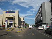 A road with a Bank Gaborone building to the left and a taller building with curved truss structures on the windows to the right
 -
Gaboronecitycentre.JPG
-
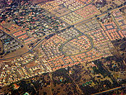 Bird's-eye view of residential neighborhoods. The houses at the bottom third of the picture have much larger yards and more trees. The neighborhood in the center of the picture has a very defined road shaped like a backwards 6, and the houses have orange and grey roofs and are very close to each other. The neighborhood at the top right has multicolor roofs. There is a road cutting through the middle of the picture.
 -
RhodesiaRailcar.jpg
-
Rhodesia Railways car at the national museum
-
 A broad view of the city facing east, the picture taken from a plane. In the middle is a large residential neighborhood. The downtown area and the Gaborone Dam are in the far right towards the horizon. At the bottom of the picture to the left is a large undeveloped area, and to the right is another neighborhood.
 -
Khama statue.jpg
-
 A broad expanse of dry savanna with hills in the background. The foreground contains large rocks on the ground with two trees flanking the sides of the picture.
 -
GaboroneSkyline.jpg
-
Skyline of Gaborone
-
 University of Botswana Administration Building
 -
University of Botswana dorms.jpg
-
Dormitories for the University of Botswana
-
 Courtyard and University of Botswana buildings
 -
University of Botswana Faculty of Business.jpg
-
University of Botswana Faculty of Business
-
 University of Botswana intramural football game
 -
Parliament Buildings, Gaborone, Botswana.jpg
-
Parliament Buildings of Botswana


References
- ^ Parsons, Neil (1999-08-19). "Botswana History Page 7: Geography". Botswana History Pages. Gaborone, Botswana: University of Botswana History Department. Retrieved 2009-08-04.
- ^ a b Modise, Oliver (2008-01-17). Mothei re-elected Gaborone mayor. Vol. 25. Gaborone, Botswana: Mmegi Online. Retrieved 2009-08-04.
- ^ a b c d e Keiner, Marco; Zegras, Christopher; Schmid, Willy A. (2004). Keiner, Marco; Zegras, Christopher; Schmid, Willy A.; Salmerón, Diego (eds.). From understanding to action: sustainable urban development in medium-sized cities in Africa and Latin America. Springer. pp. 19, 63, 68, 93. ISBN 9781402028793. Retrieved 2009-08-06.
- ^ "Gaborone, Botswana Page". Falling Rain Genomics, Inc.
- ^ a b c d e f g Central Statistics Office (2009-01). "BOTSWANA DEMOGRAPHIC SURVEY 2006" (PDF). Gaborone, Botswana. Retrieved 2010-07-03.
{{cite web}}: Check date values in:|date=(help) - ^ timeanddate.com
- ^ Botswana Telecommunications Authority (2009-09-11). Botswana (country code +267). International Telecommunication Union. Archived from the original (DOC) on 2009-12-27. Retrieved 2009-12-27.
{{cite book}}:|work=ignored (help) - ^ a b c d e Njeru, Purity (2009). "History of Gaborone". Nairobi, Kenya: The African Executive. Retrieved 2009-08-04.
- ^ a b c d e f g h i j Seth, Willie (2008). "Major urban centres". Botswana and Its People. Godfrey Mwakikagile. pp. 44–46. ISBN 9780981425870. Retrieved 2009-08-04.
{{cite book}}: External link in|chapterurl=|chapterurl=ignored (|chapter-url=suggested) (help) - ^ a b c d e f g h Hardy, Paula; Firestone, Matthew D. (2007). "Gaborone". Botswana & Namibia. Lonely Planet. pp. 75–88. ISBN 9781741047608. Retrieved 2009-08-04.
{{cite book}}: External link in|chapterurl=|chapterurl=ignored (|chapter-url=suggested) (help) - ^ "African cities- Gaborone History". Gaborone.info. AfricanCities.net. Retrieved 2009-08-04.
- ^ "Regions Given New Spelling". Spokane Daily Chronicle. Spokane, Washington, USA. Associated Press. 1969-12-22. p. 11. Retrieved 2010-07-11.
- ^ Paine, David J. (1966-04-15). "Capital City Being Built On Virgin Soil". Eugene Register-Guard. Eugene, Oregon, USA. Associated Press. section D, p. 3. Retrieved 2010-07-11.
- ^ killion (2009-06-29). "The Unsustainable urban growth of Gaborone City, Botswana". Boidus: Blogs. Retrieved 2009-08-04.
- ^ Van Nostrand, John Cornelius (1982). "Old Naledi: History of Settlement". Old Naledi, the village becomes a town: an outline of the Old Naledi Squatter Upgrading Project, Gaborone, Botswana. James Lorimer & Company. pp. 13–15. ISBN 9780888626509. Retrieved 2009-09-19.
{{cite book}}: External link in|chapterurl=|chapterurl=ignored (|chapter-url=suggested) (help) - ^ a b Grant, Sandy (2009-06-18). Our Heritage. Vol. 26. Gaborone, Botswana: Mmegi Online. Retrieved 2009-08-06.
- ^ a b c d e LeVert, Suzanne (2007). Botswana. Marshall Cavendish. p. 15, 27–28, 105. ISBN 9780761423300. Retrieved 2009-08-06.
- ^ Carr, Michael (1997). "The form and future shape of the modem city". New patterns: process and change in human geography (2nd ed.). Nelson Thornes. p. 224. ISBN 9780174386810. Retrieved 2009-08-06.
{{cite book}}: External link in|chapterurl=|chapterurl=ignored (|chapter-url=suggested) (help) - ^ a b Phakalane Properties (2008). "Gaborone Information - Phakalane Properties, Botswana". Phakalane, Botswana. Retrieved 2009-08-04.
- ^ a b Central Statistics Office (2009-08). "NATURAL DISASTERS DIGEST 2008" (PDF). Gaborone, Botswana. Retrieved 2010-07-03.
{{cite web}}: Check date values in:|date=(help) - ^ a b c d Bauer, Carl (2005). "Climate" (PDF). Energy Efficiency and Energy Conservation in the Building Sector in Botswana. Gaborone, Botswana: Bauer Consult. pp. 6–13. Retrieved 2009-08-04.
- ^ a b c d e "Weatherbase: Historical Weather for Gaborone, Botswana". Weatherbase. Retrieved 2009-08-04.
- ^ Central Statistics Office. "Table 1.6: Distribution of Population in Urban Settlements: 1971- 2001 Censuses". Gaborone, Botswana. Retrieved 2009-12-27.
- ^ Central Statistics Office (2008-02-07) [2001]. "Table 1.1: Population by sex and census districts (1991 And 2001)". Gaborone, Botswana. Retrieved 2009-08-05.
- ^ a b Central Statistics Office (February 2005). "2001 POPULATION CENSUS ATLAS: BOTSWANA" (PDF). Gaborone, Botswana. Retrieved 2009-08-05.
- ^ A. N. Majelantle (2010). "MARRIAGE STATISTICS 2007". STATS BRIEF. Gaborone, Botswana: Central Statistics Office. p. 2. Archived from the original (PDF) on 2010-07-04. Retrieved 2010-07-06.
{{cite web}}: Unknown parameter|month=ignored (help) - ^ Cheney, David M. (2009-05-10). "Gaborone (Diocese) [Catholic-Hierarchy]". Dioceses. www.Cathoic-Hierarchy.org. Retrieved 2009-08-06.
- ^ Diocese of Gaborone, Botswana. Giga-Catholic Information. 2009-07-19. Retrieved 2009-08-06.
{{cite book}}:|work=ignored (help) - ^ High Level Committee On Indian Diaspora (2001-12-19). "Chapter 8 – Other Countries of Africa". Report of the High Level Committee on the Indian Diaspora (PDF). Vol. 2. New Delhi. pp. 102–103. Retrieved 2009-08-06.
{{cite book}}: External link in|chapterurl=|chapterurl=ignored (|chapter-url=suggested) (help)CS1 maint: location missing publisher (link) - ^ African abode for the Lord of the Seven Hills. Hyderabad: The Hindu. 2006-02-27. Retrieved 2009-08-06.
{{cite book}}:|work=ignored (help) - ^ Dinamalar.com _ Ulagatamilargal. Dina Malar. 2007-09-19. Retrieved 2009-08-06.
{{cite book}}:|work=ignored (help) - ^ a b c d e f g Gaborone City map (Map). Botswana Maps. Botswana Tourism Board. 2001. Retrieved 2009-08-04.
- ^ Botswana Tourism Board. "The National Museum and Art Gallery". Attractions. Botswana Tourism Board. Retrieved 2009-08-05.
- ^ a b "Gabarone Holidays – a Visit to the Vibrant Cosmopolitan Capital". 2006-05-24. Retrieved 2009-08-05.
- ^ a b Botanic Gardens Conservation International. "National Botanical Garden". Retrieved 2009-09-19.
- ^ "National Museum to Launch Botanical Garden". Daily News Online. Republic of Botswana. 2007-10-25. Retrieved 2009-08-05.
- ^ Debswana. "BOTSWANA DIAMOND VALUING COMPANY". ABOUT DEBSWANA. Debswana. Retrieved 2009-08-05.
- ^ a b "African cities- Gaborone Culture". Gaborone.info. AfricanCities.net. Retrieved 2009-08-05.
- ^ "Worldwide Cost of Living survey 2010 - City rankings". Cost of Living Survey. London: Mercer. 2010-06-29. Retrieved 2010-07-06.
- ^ worldstadia.com. "Stadiums in Gaborone". Retrieved 2010-07-01.
- ^ World Stadiums. "Stadiums in Botswana". Retrieved 2010-07-01.
- ^ a b c d Majelantle, A. (2009). "BOTSWANA WATER STATISTICS". Botswana Water Statistics. Gaborone, Botswana: Central Statistics Office. Archived from the original (PDF) on 2010-07-07. Retrieved 2010-07-07.
{{cite web}}: Unknown parameter|month=ignored (help) - ^ Gabscity.com. "City – Gabscity.com all about Gaborone". Gaborone, Botswana. Retrieved 2009-08-04.
- ^ a b Botswana Tourism Board. "Gaborone Game Reserve". Attractions. Botswana Tourism Board. Retrieved 2009-08-05.
- ^ a b Mokolodi Nature Reserve. "Introduction". Mokolodi Nature Reserve. Retrieved 2009-08-05.
- ^ Somarelang Tikologo. "What is ST?". Somarelang Tikologo. Retrieved 2009-09-17.
- ^ History. ILEA Gaborone-Botswana. 2009-06-29. Retrieved 2009-08-06.
- ^ "Serara T. Ketlogetswe, Botswana's Ambassador, 68". New York Times. Obituaries. 1998-10-11. p. 26. Retrieved 2009-08-06.
- ^ Mooketsi, Lekopanye (2008-08-08). Ramaotwana quits politics to join AG's Chambers. Vol. 25. Gaborone, Botswana: Mmegi Online. Retrieved 2009-08-06.
- ^ Molefhe, Rampholo (2005-05-23). The Paul Rantao That I Knew. Vol. 22. Gaborone, Botswana: Mmegi. Retrieved 2009-08-06.
{{cite book}}: More than one of|number=and|issue=specified (help) - ^ "Ministry of Foreign Affairs and International Cooperation – Missions Accredited to Botswana". 2009-04-17. Retrieved 2010-06-26.
- ^ "Ministry of Foreign Affairs and International Cooperation – International Organizations Based in Botswana". 2008-09-07. Retrieved 2010-06-26.
- ^ a b Denbow, James Raymond; Thebe, Phenyo C. (2006). "Literature and Media". Culture and customs of Botswana. Greenwood Publishing Group. pp. 72–73. ISBN 9780313331787. Retrieved 2009-08-06.
{{cite book}}:|work=ignored (help); External link in|chapterurl=|chapterurl=ignored (|chapter-url=suggested) (help) - ^ Cavric, Branko I.; Mosha, Aloysius C. (2001). "Incorporating Urban Agriculture In Gaborone City Planning" (PDF). Urban Agriculture Magazine. 4. RUAF Foundation: 25–27. Retrieved 2009-08-04.
{{cite journal}}: External link in|volume=|author=and|last1=specified (help); Unknown parameter|month=ignored (help) - ^ a b "Gaborone: a capital city w/ a strange design". 2008-02-25. Retrieved 2009-08-04.
- ^ Gabscity.com. "Home – Gabscity.com all about Gaborone". Gaborone, Botswana. Retrieved 2009-08-04.
- ^ Mosinyi, Wanetsha (2009-05-08). New CBD threatens office space market. Gaborone, Botswana: Mmegi Online. Retrieved 2009-08-06.
- ^ Ministry of Labour and Home Affairs. "The Industrial Court of Botswana". Gaborone, Botswana: Republic of Botswana. Retrieved 2009-08-06.
- ^ "Historians support dikgosi statues". Gaborone, Botswana: Gabscity.com. 2005-09-08. Retrieved 2010-06-30.
- ^ Staff Writer (2005-12-19). "The Highlights Of An Eventful Year". Gaborone, Botswana: Mmegi Online. Retrieved 2010-06-30.
- ^ Keto Segwai (2006-07-28). "Three dikgosi in waiting". Gaborone, Botswana: Mmegi Online. Retrieved 2010-06-30.
- ^ Benza, Brian (2008-08-11). Masa Towers To Cost P275 Million – Giachetti. Vol. 25. Gaborone, Botswana: Mmegi Online. Retrieved 2009-08-06.
- ^ Princess Marina Hospital improvements - VelaVKE
- ^ Botswana Railway Network (Map). 1 : 8,000,000. Botswana Maps. Botswana Tourism Board. Retrieved 2009-08-04.
- ^ Malikongwa, Lewis (2009-02-27). Termination of Botswana Railways' Passenger Service. Botswana: Ministry of Works and Transport. Retrieved 2009-08-04.
- ^ a b Airport information for Sir Seretse Khama International Airport at Great Circle Mapper.
- ^ Domestic & international airline routes map (Map). Botswana Maps. Botswana Tourism Board. Retrieved 2009-08-04.
- ^ a b Airport information for Maun Airport at Great Circle Mapper.
- ^ a b c A. N. Majelantle (2009). "BOTSWANA TRANSPORT STATISTICS - 2008". Botswana Transport Statistics. Gaborone, Botswana: Central Statistics Office. Archived from the original (PDF) on 2010-07-06. Retrieved 2010-07-06.
{{cite web}}: Unknown parameter|month=ignored (help) - ^ BBC News Online (1999-10-11). Suicide pilot destroys Air Botswana fleet. BBC News Online. Retrieved 2009-08-06.
{{cite book}}:|work=ignored (help) - ^ Road network map (Map). 1 : 6,000,000. Botswana Maps. Botswana Tourism Board. lower right inset. Retrieved 2009-08-04.
External links
 Definitions from Wiktionary
 Media from Commons
- Template:Wikitravel
- Gaborone Satellite view at WikiMapia (not affiliated with Wikipedia/Wikimedia Foundation)
- Gaborone Encyclopædia Britannica entry
- Gaborone – Botswana Tourism Board
- Map of Gaborone

